Artillery preserved in New Brunswick
Artillerie préservée au Nouveau-Brunswick
St. Andrews-by-the-Sea
The aim of this website is to locate, identify and document every historical piece of artillery preserved in Canada. Many contributors have assisted in the hunt for these guns to provide and update the data found on these web pages. Photos are by the author unless otherwise credited. Any errors found here are by the author, and any additions, corrections or amendments to this list of Guns and Artillery in Canada would be most welcome and may be e-mailed to the author at hskaarup@rogers.com.
For all official data concerning the Royal Regiment of Canadian Artillery, please click on the link to their website:
Royal Regiment of Canadian Artillery Website
Note: Back in the day, artillery in Canada was referred to by its radio call sign “Sheldrake”. It is now referred to by its “Golf” call sign. (Acorn sends)
Une traduction au français pour l’information technique présente serait grandement apprécié. Vos corrections, changements et suggestions sont les bienvenus, et peuvent être envoyés au hskaarup@rogers.com.
New Brunswick
St. Andrews by the Sea
(Author Photo, 28 July 2019)
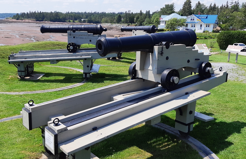
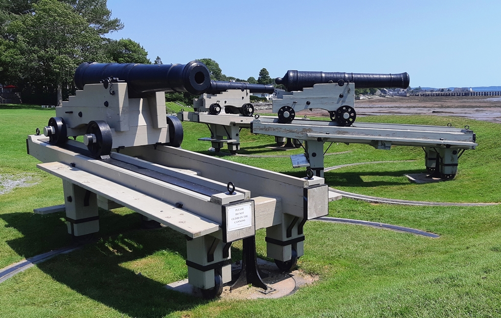
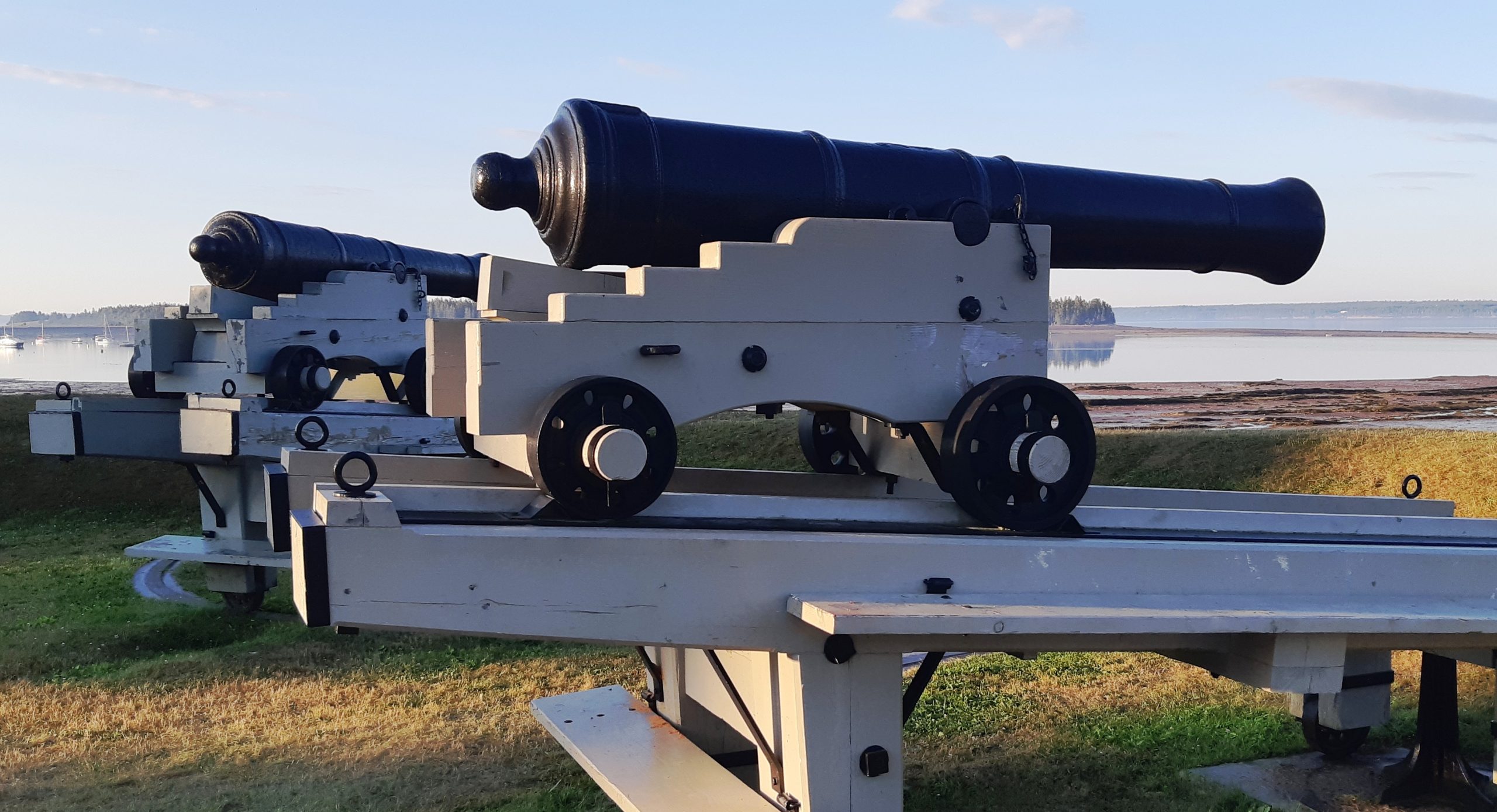
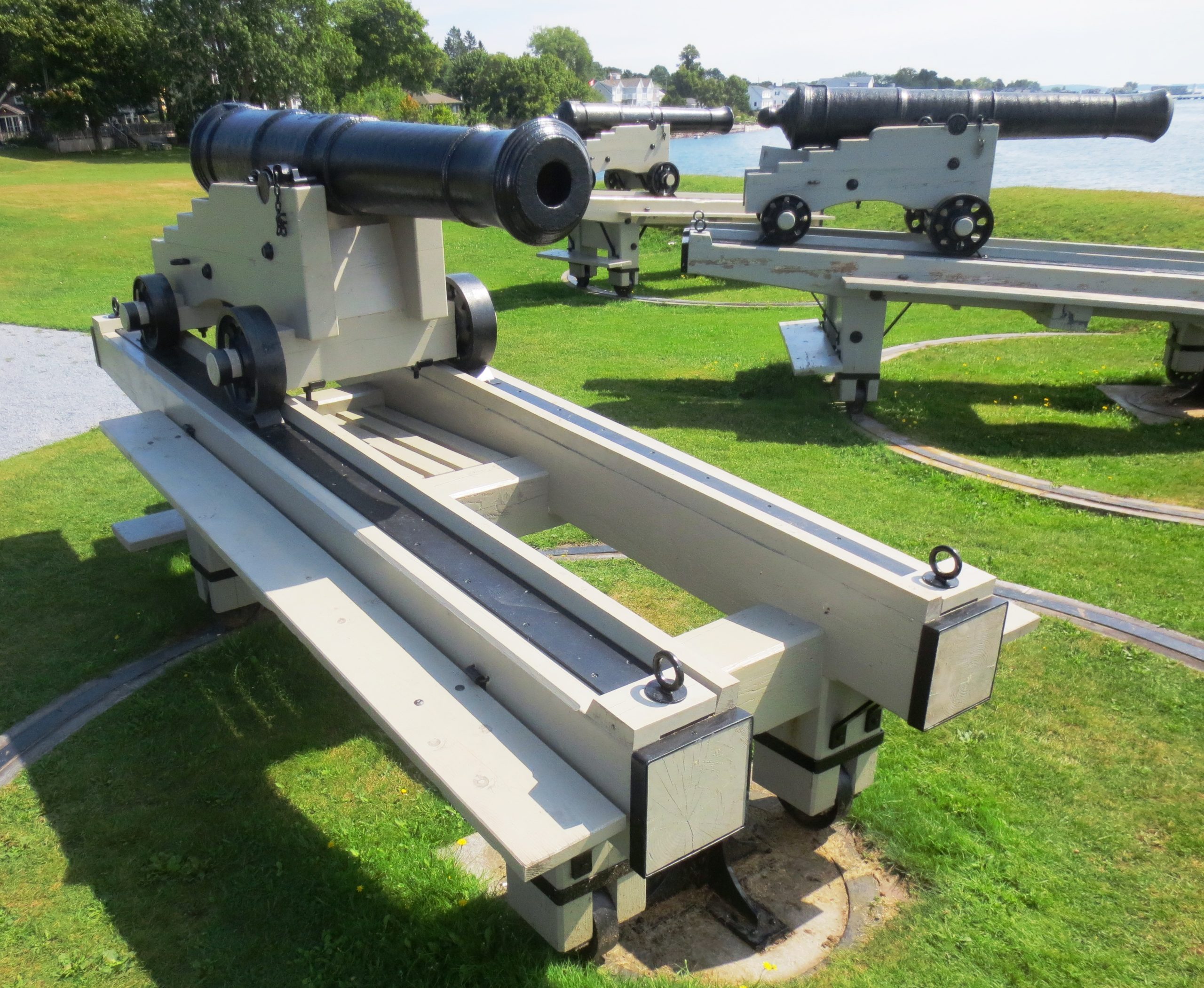
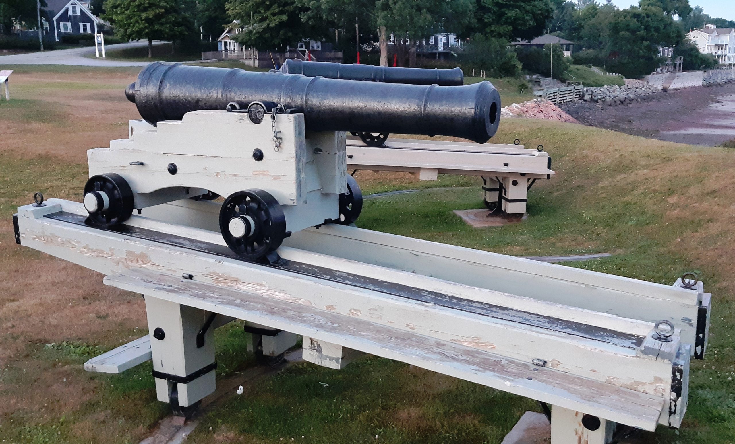
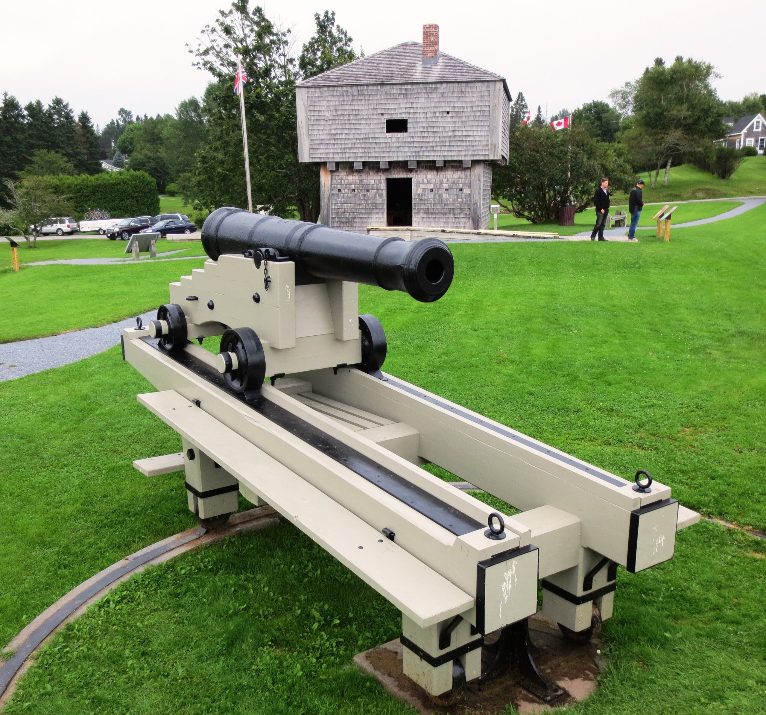
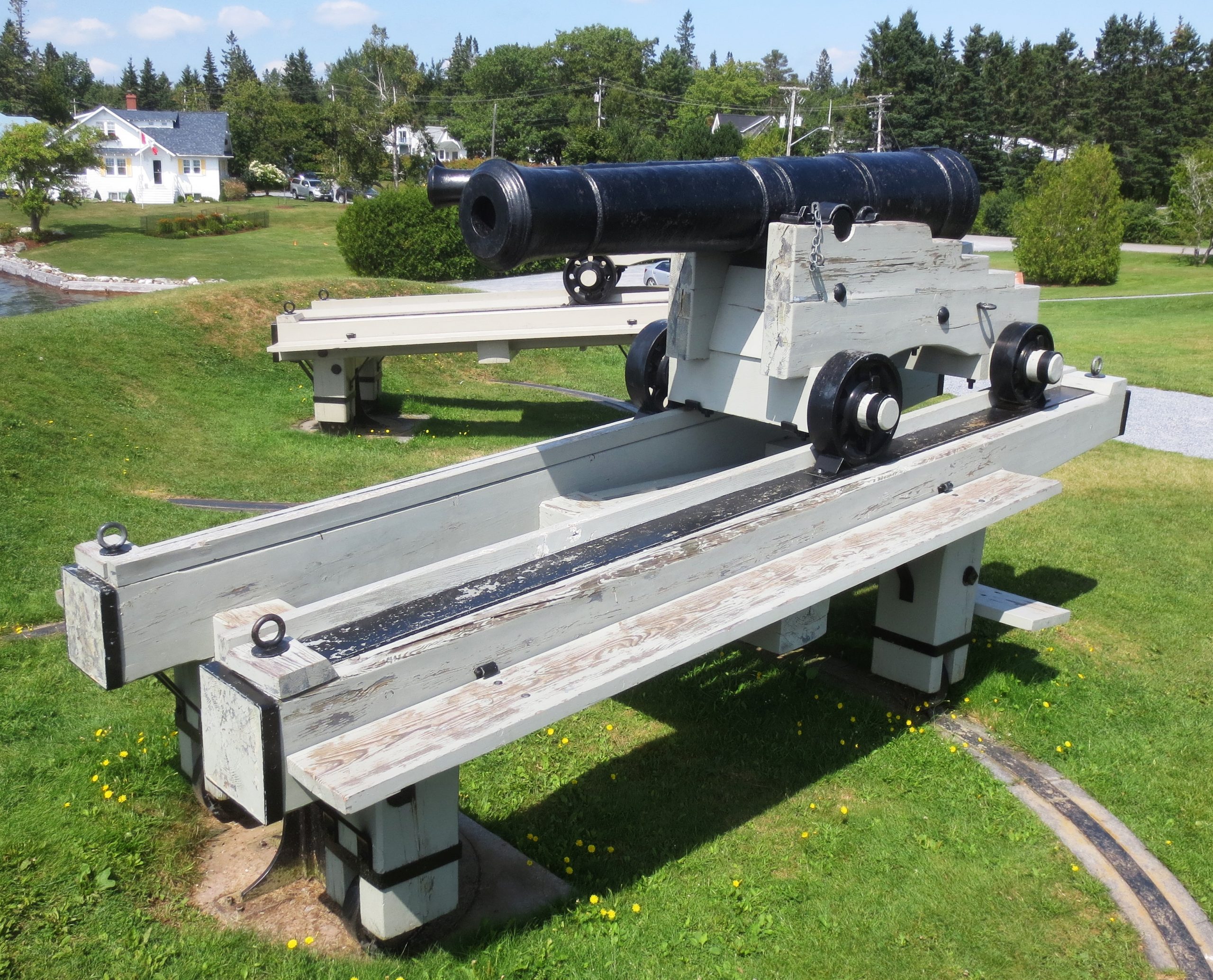
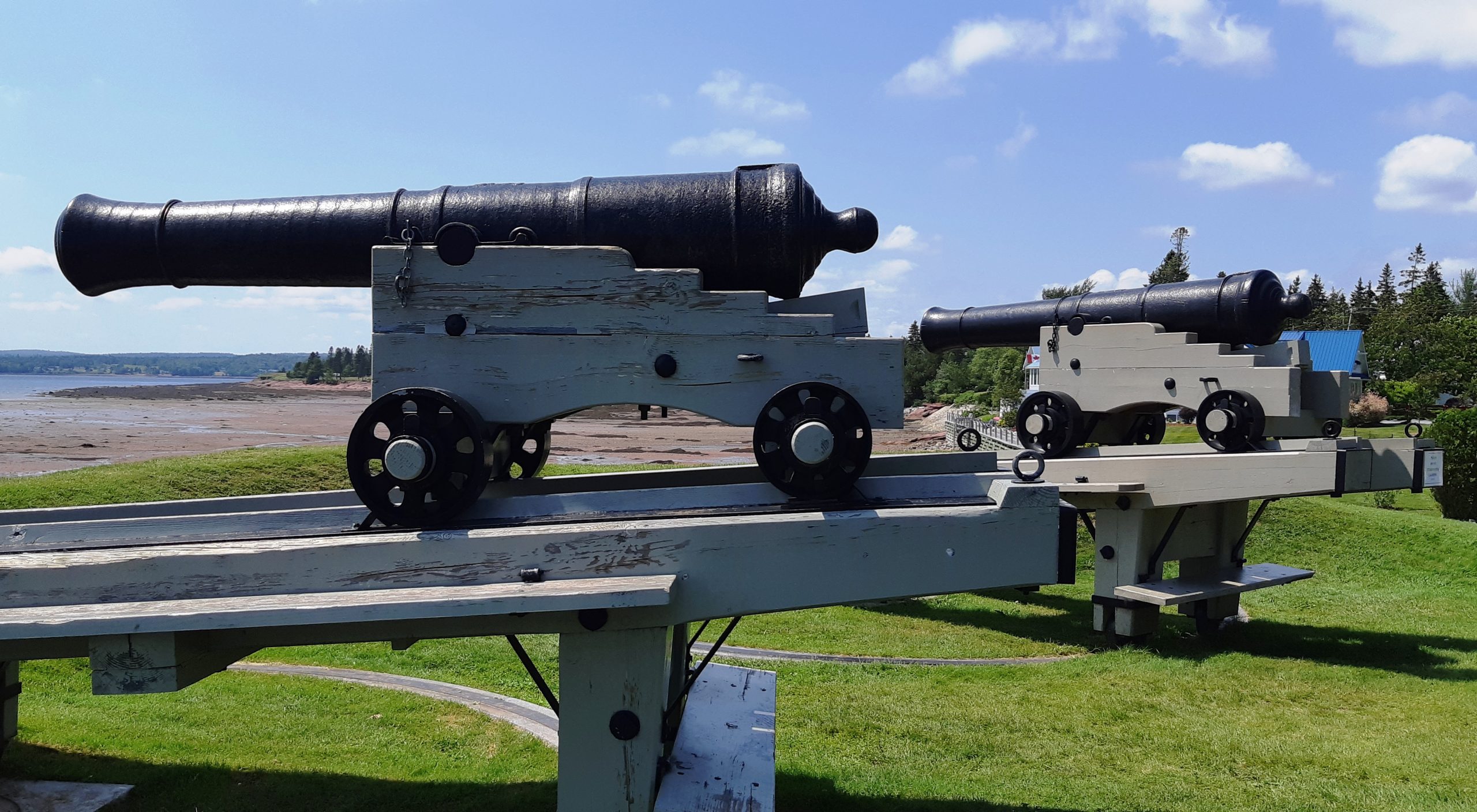
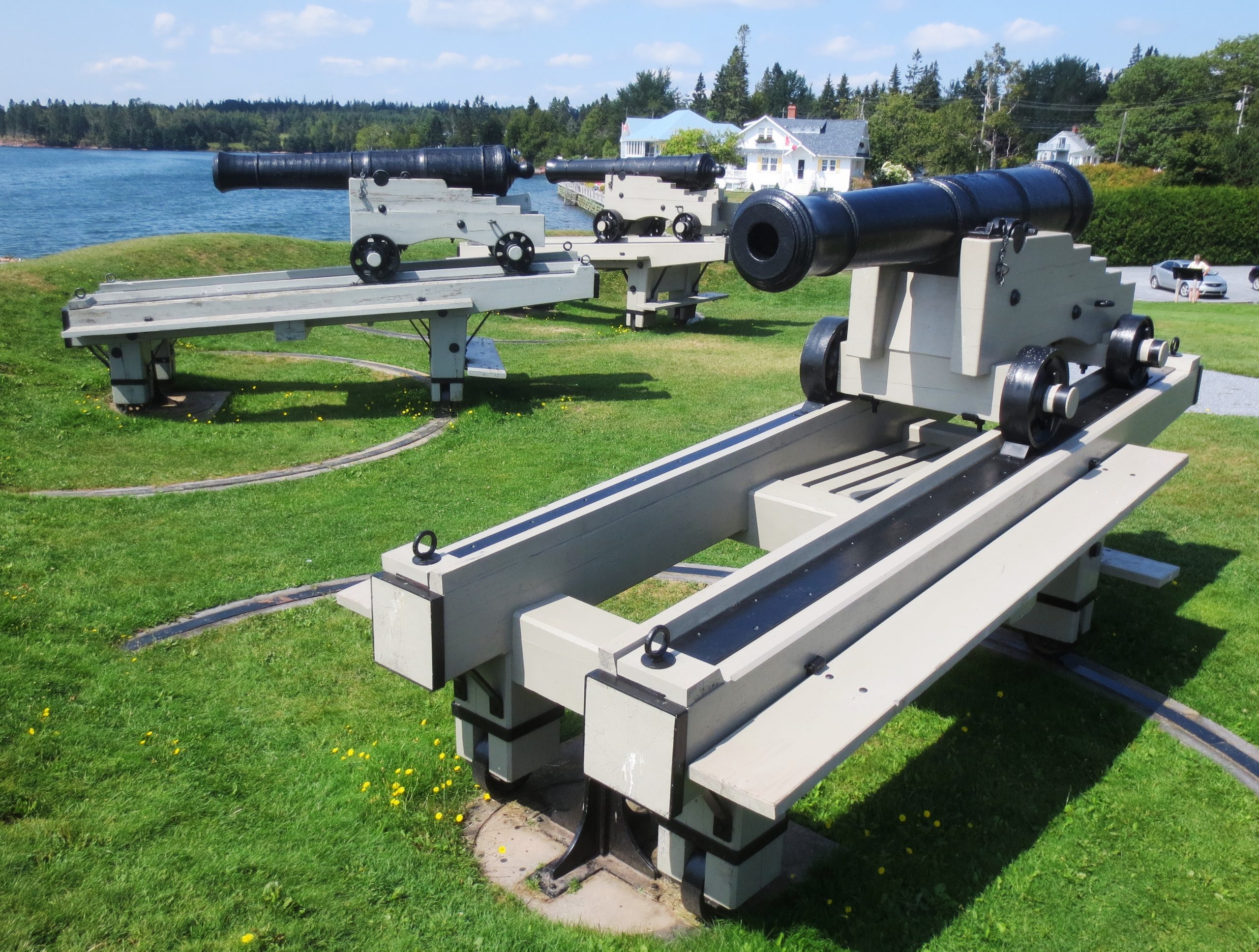
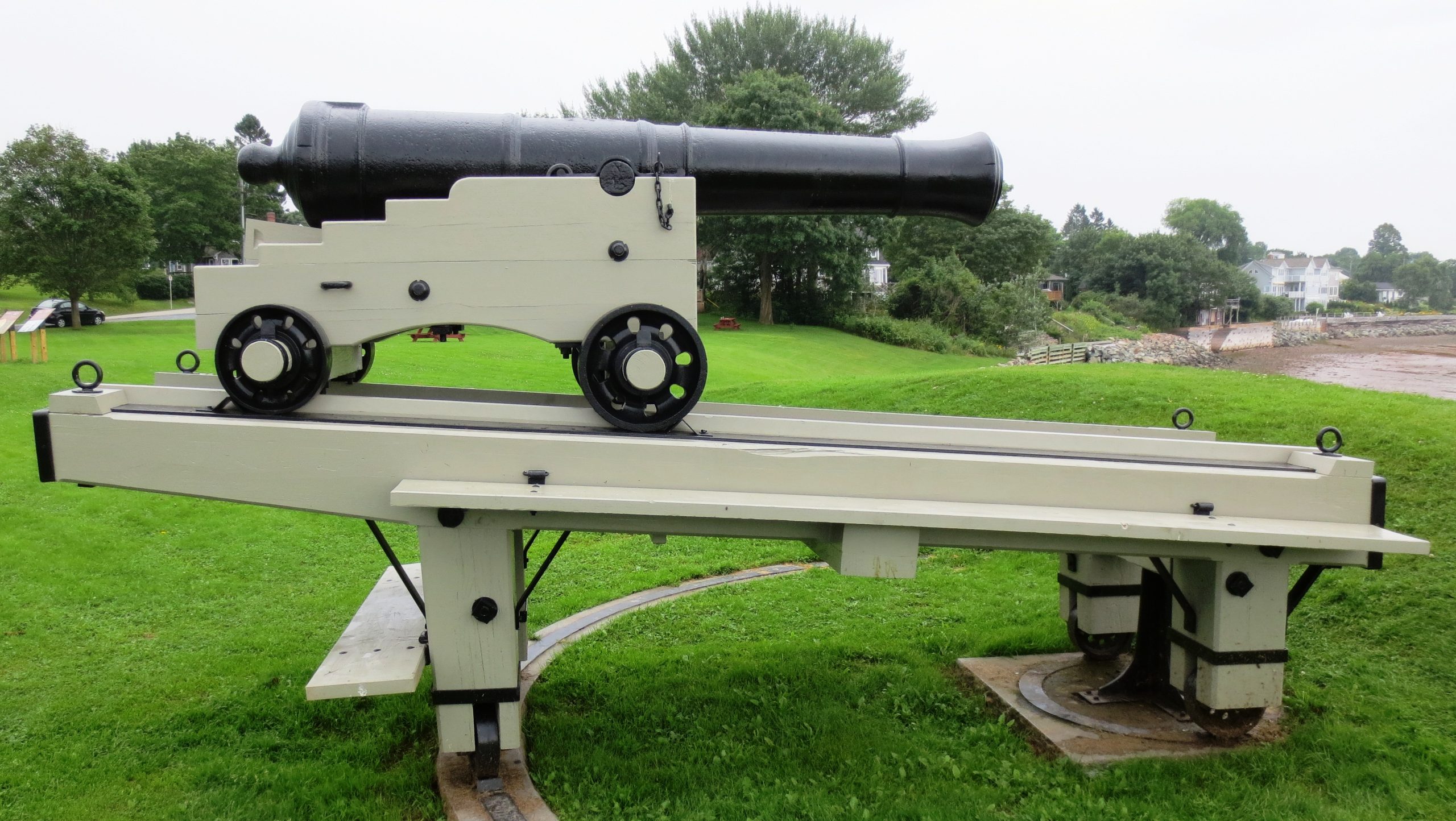
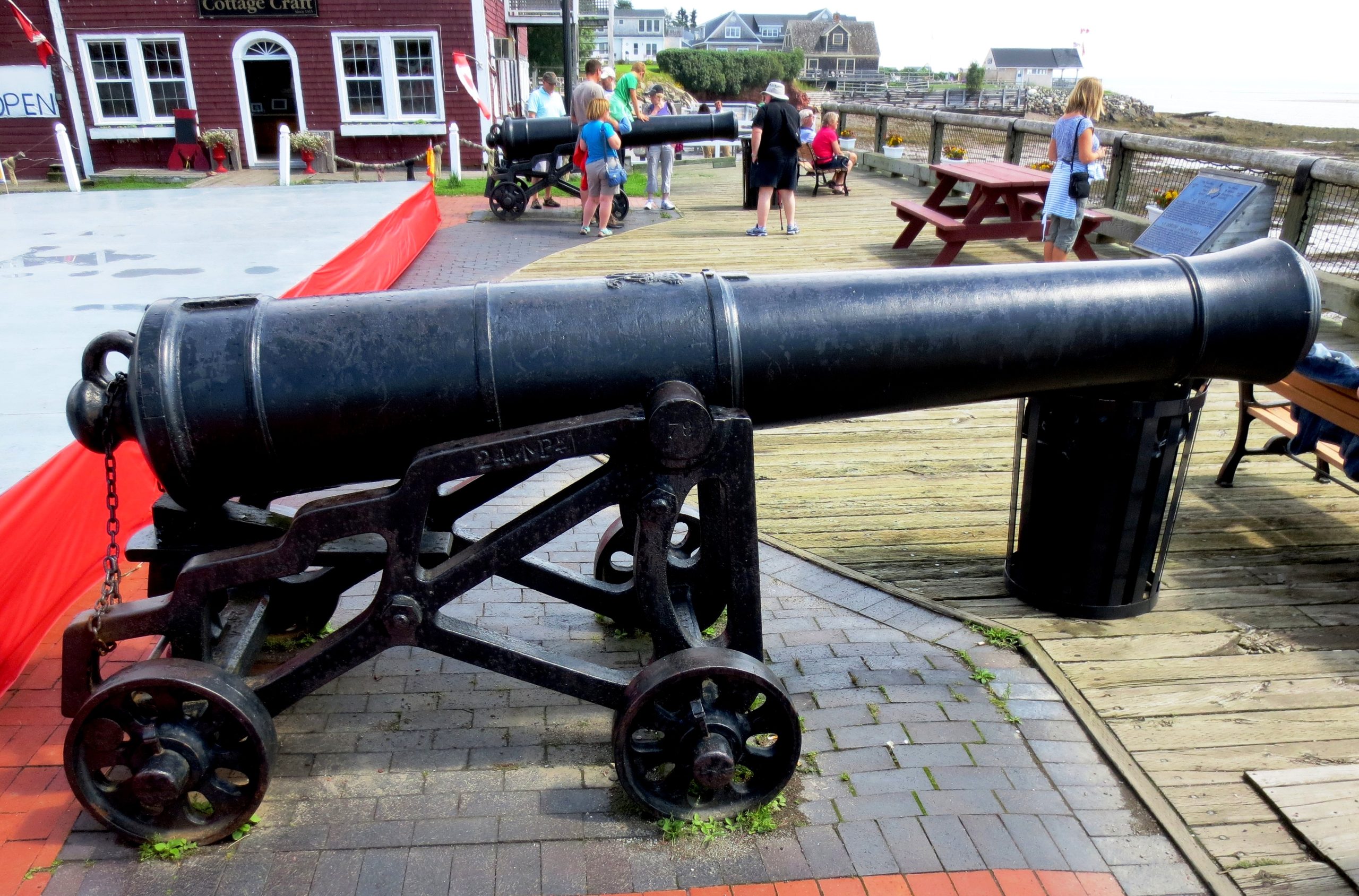
Three Cast Iron 18-pounder Smoothbore Muzzleloading Guns, 41 hundredweight, trunnion data heavily corroded and painted over(4,000+ lbs), King George III cypher, ca. 1760-1780, mounted on a long wood traversing gun carriages in front of the Blockhouse at St. Andrews Block House National Historic site.
(Author Photo, 21 July 2020)
(Author Photo, 28 July 2019)
(Author Photo, 21 July 2020)
Three Cast Iron 18-pounder Smoothbore Muzzleloading Guns, weight and trunnion data heavily corroded and painted over(4,000+ lbs), King George III cypher, ca. 1760-1780, mounted on a long wood traversing gun carriages in front of the Blockhouse at St. Andrews Block House National Historic site.
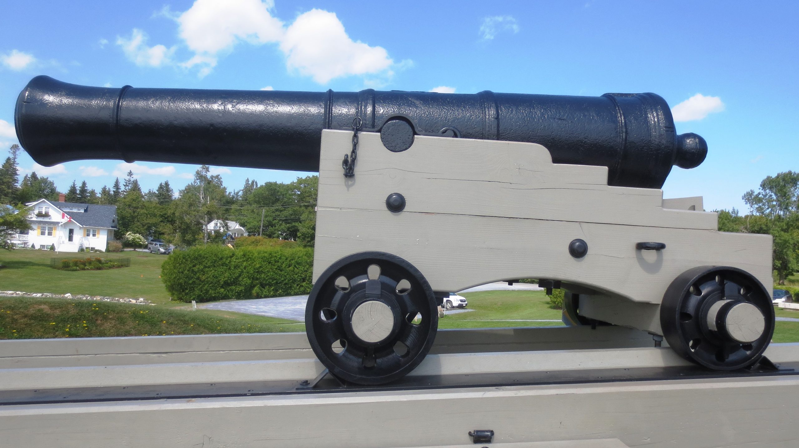
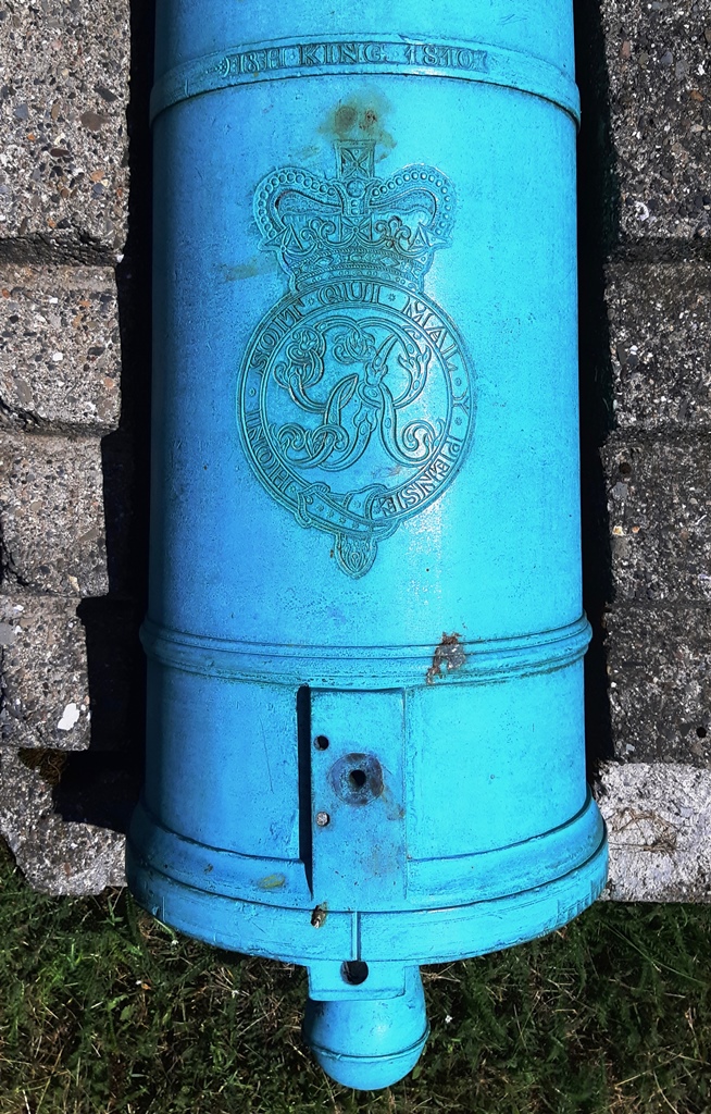
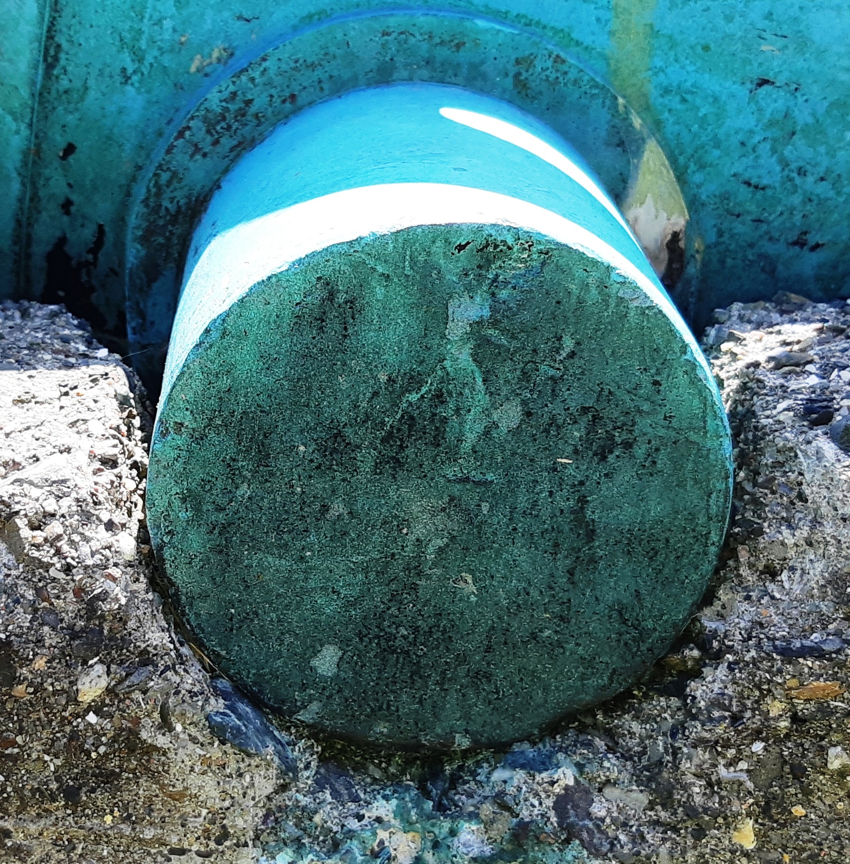
Cast Iron 18-pounder Smoothbore Muzzleloading Gun, weight and trunnion data heavily corroded and painted over(4,000+ lbs), King George III cypher, ca. 1760-1780, mounted on a long wood traversing gun carriage, St. Andrews Block House National Historic site. No. 1 of 3.
(Author Photo, 21 July 2020)
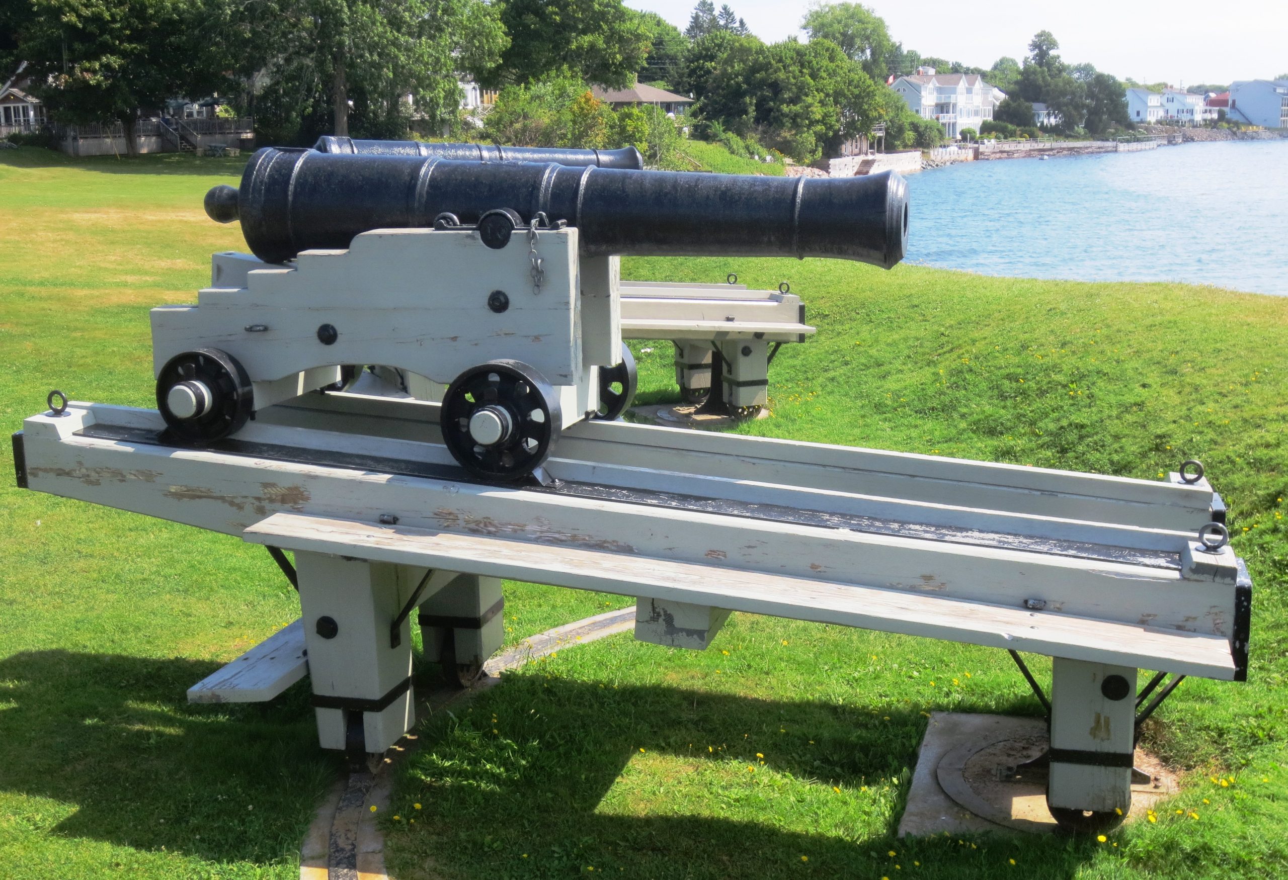
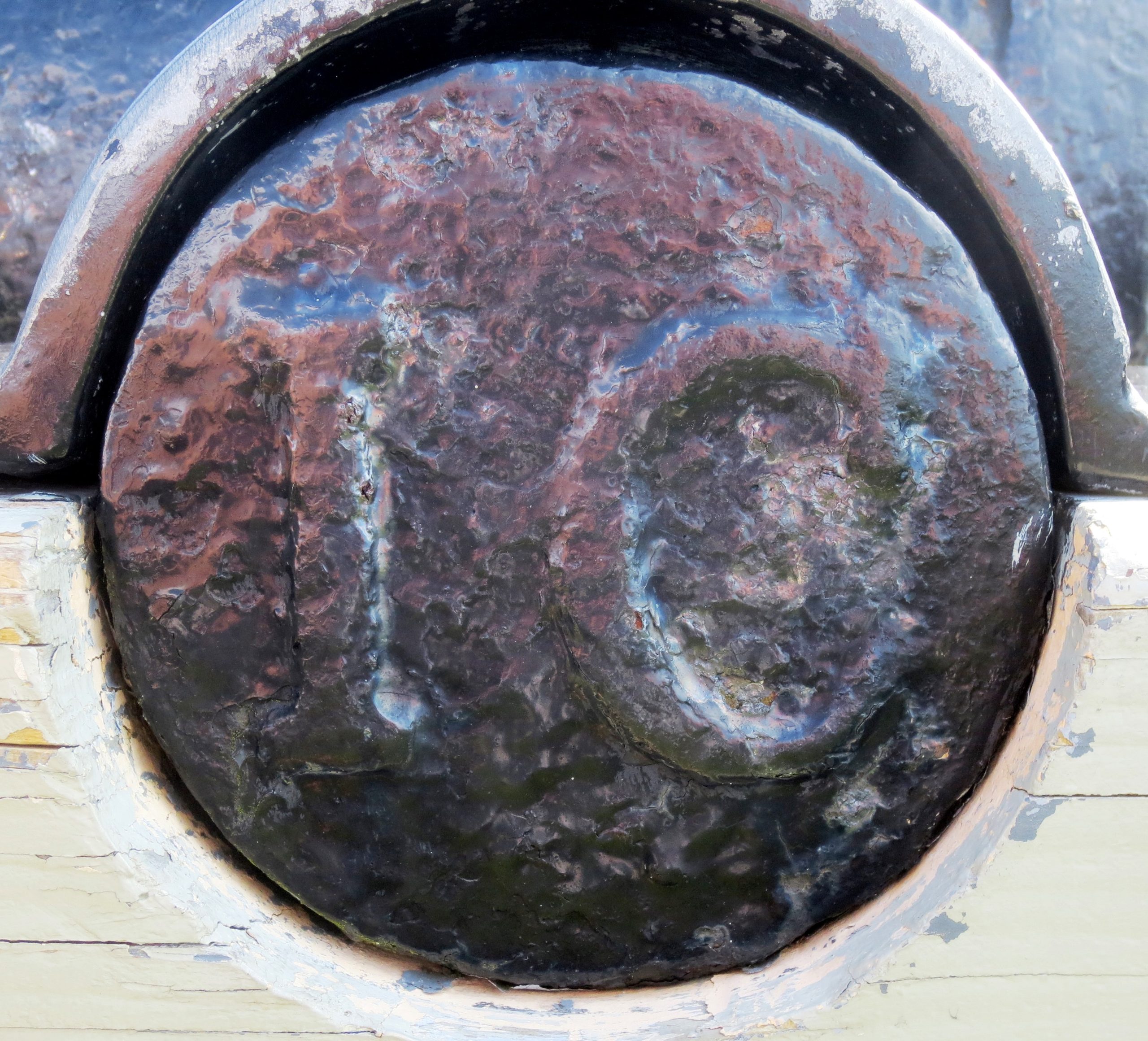
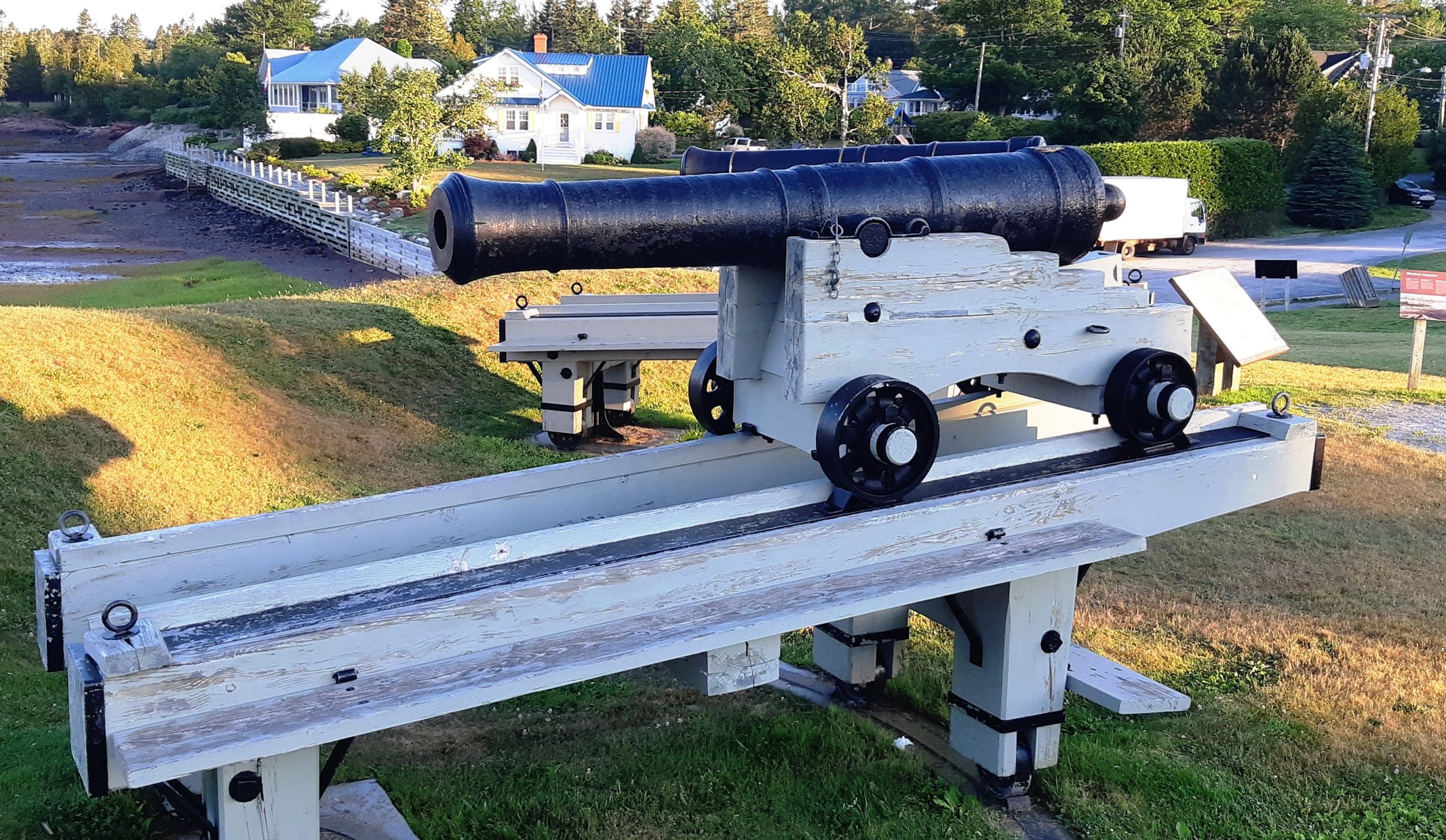
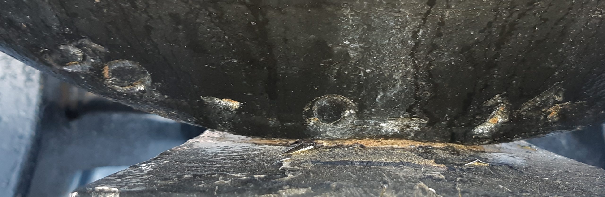
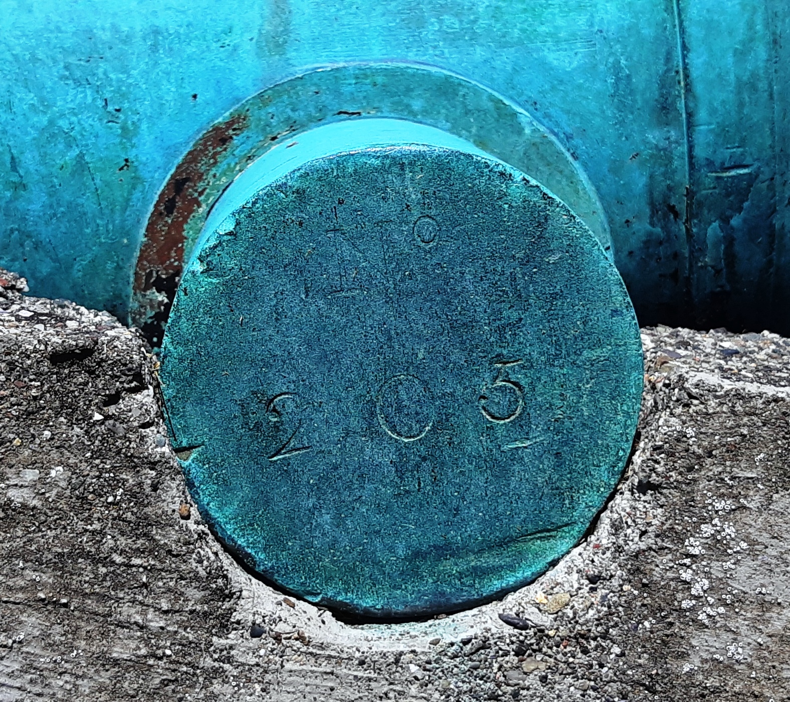
Cast Iron 18-pounder Smoothbore Muzzleloading Gun, weight 40-2-7 (4,543 lbs), (IC) on the right trunnion, possibly (Serial No. 23) on left trunnion, King George III cypher, ca. 1760-1780, mounted on a long wood traversing gun carriage, St. Andrews Block House National Historic site. No. 2 of 3.
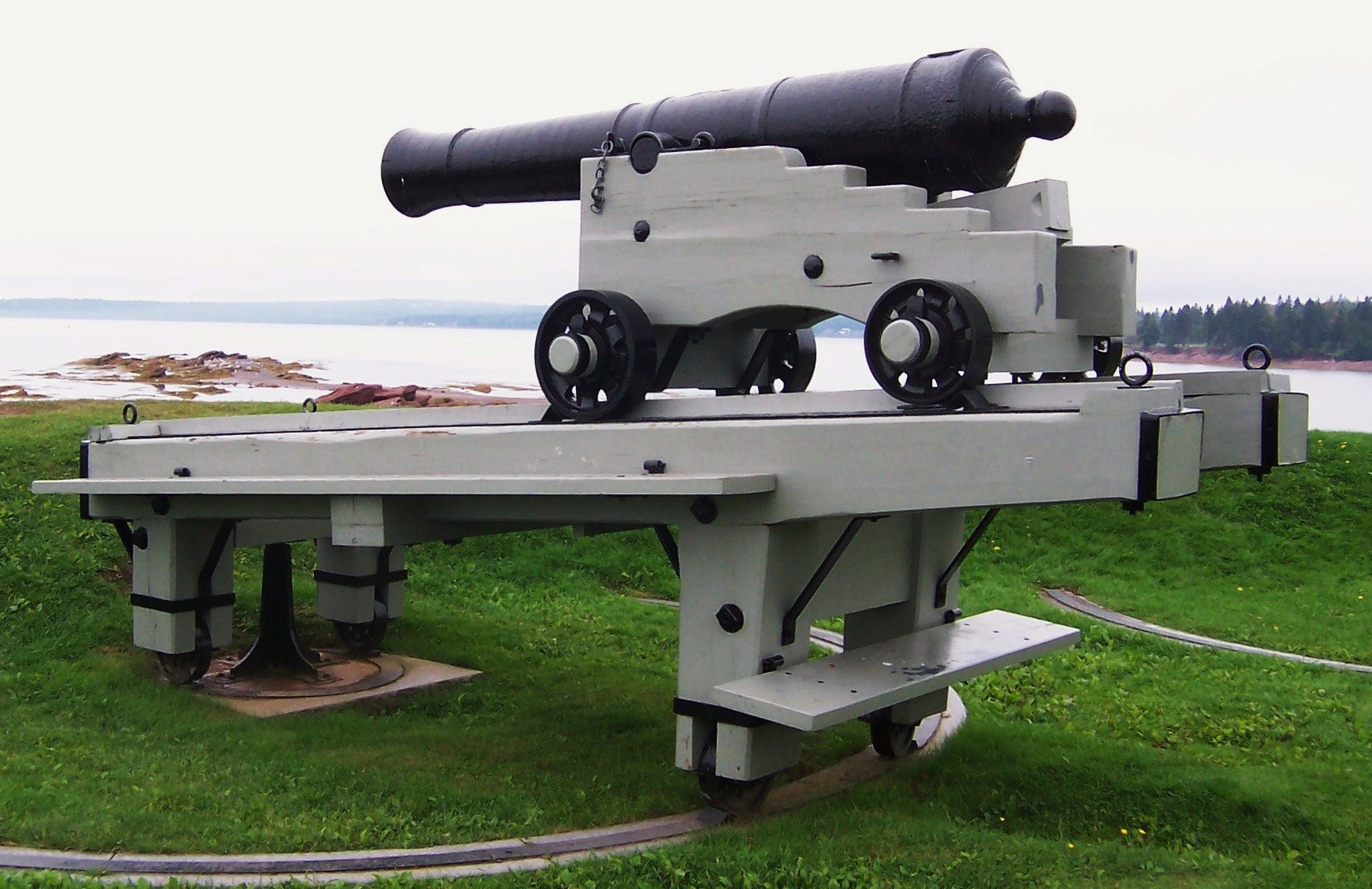
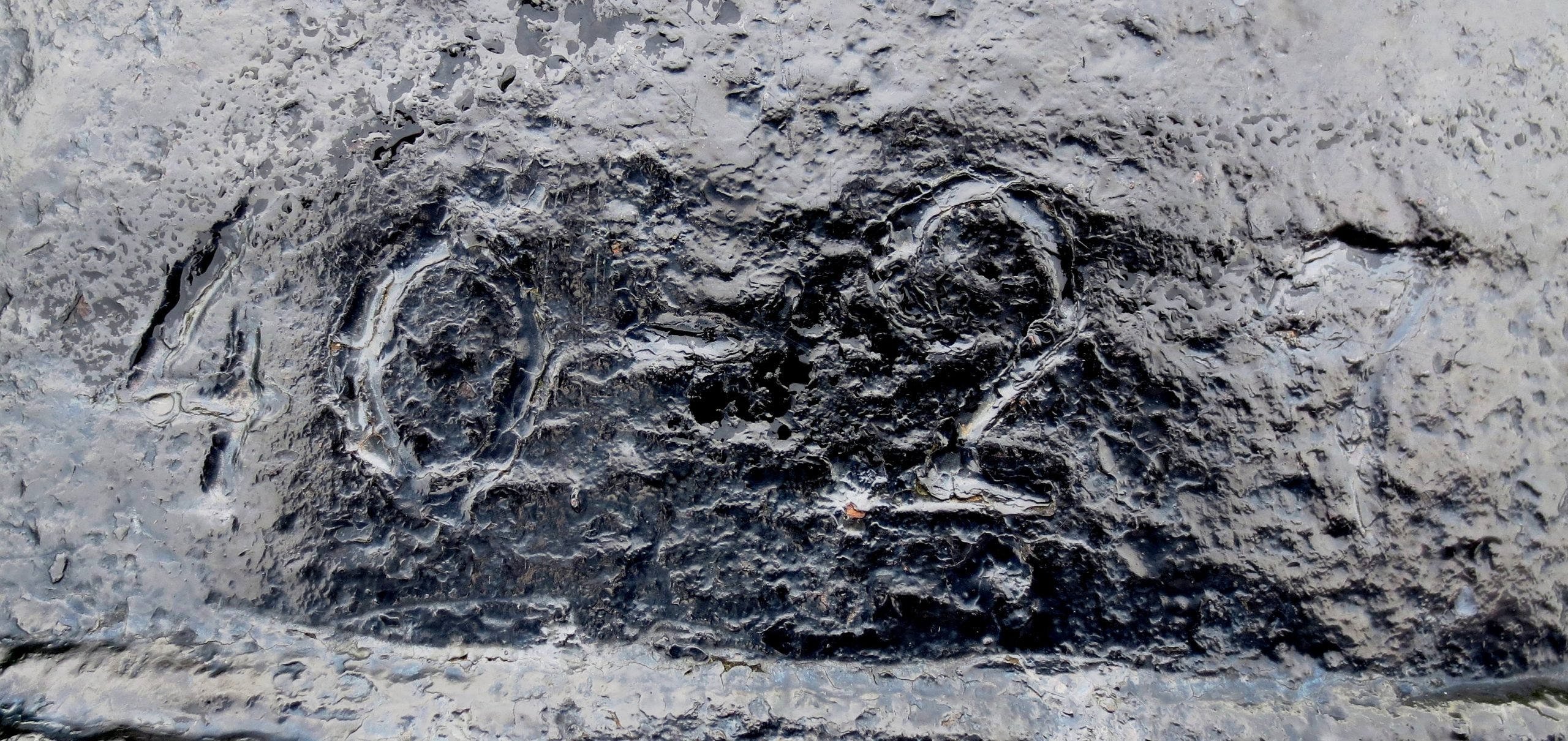
Cast Iron 18-pounder Smoothbore Muzzleloading Gun, weight 41-1-24 (4,644 lbs), possibly (N15) on right trunnion, blank on left trunnion, King George III cypher, ca. 1760-1780, mounted on a long wood traversing gun carriage, St. Andrews Block House National Historic site, Joe’s Point Road. No. 3 of 3.
(Author Photo)
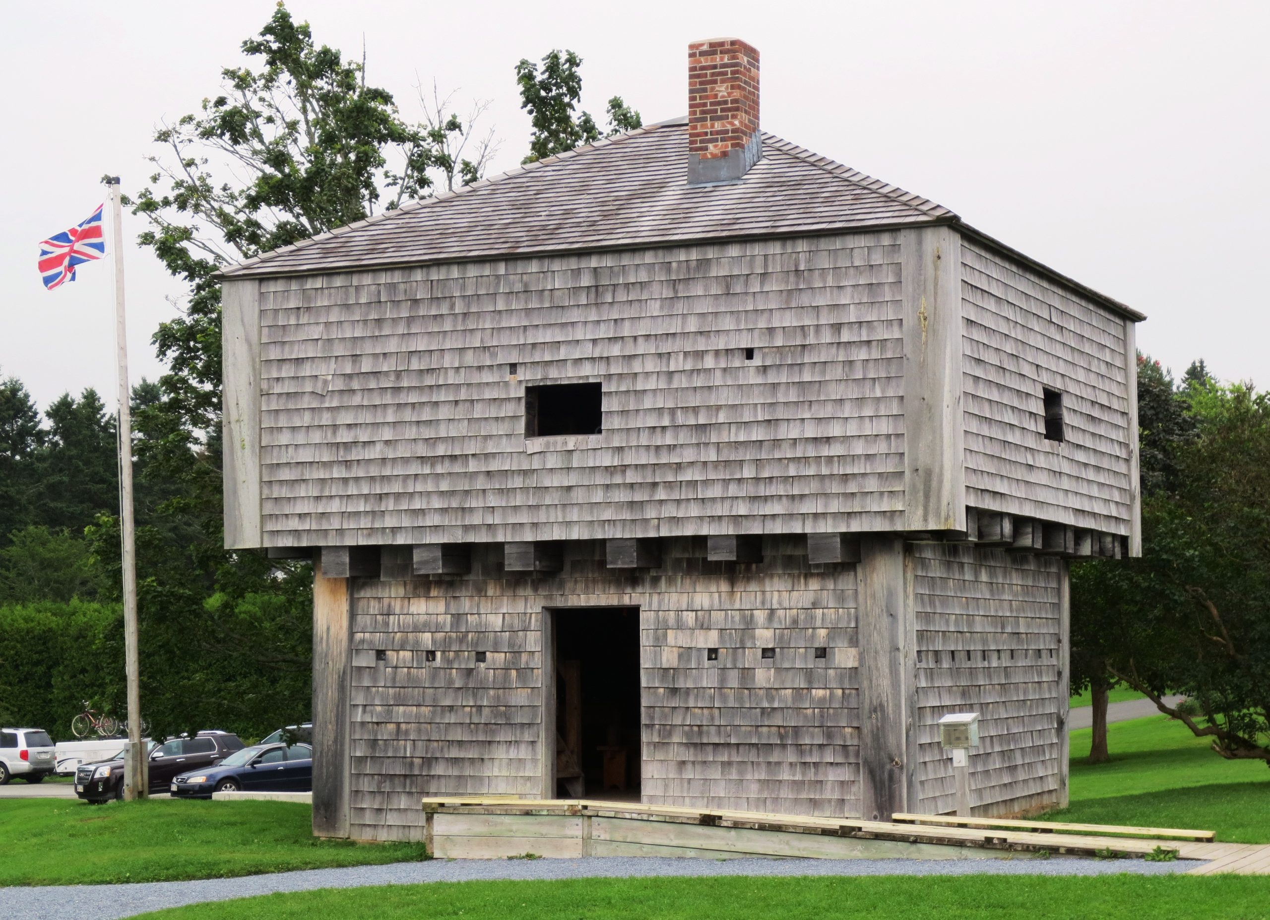
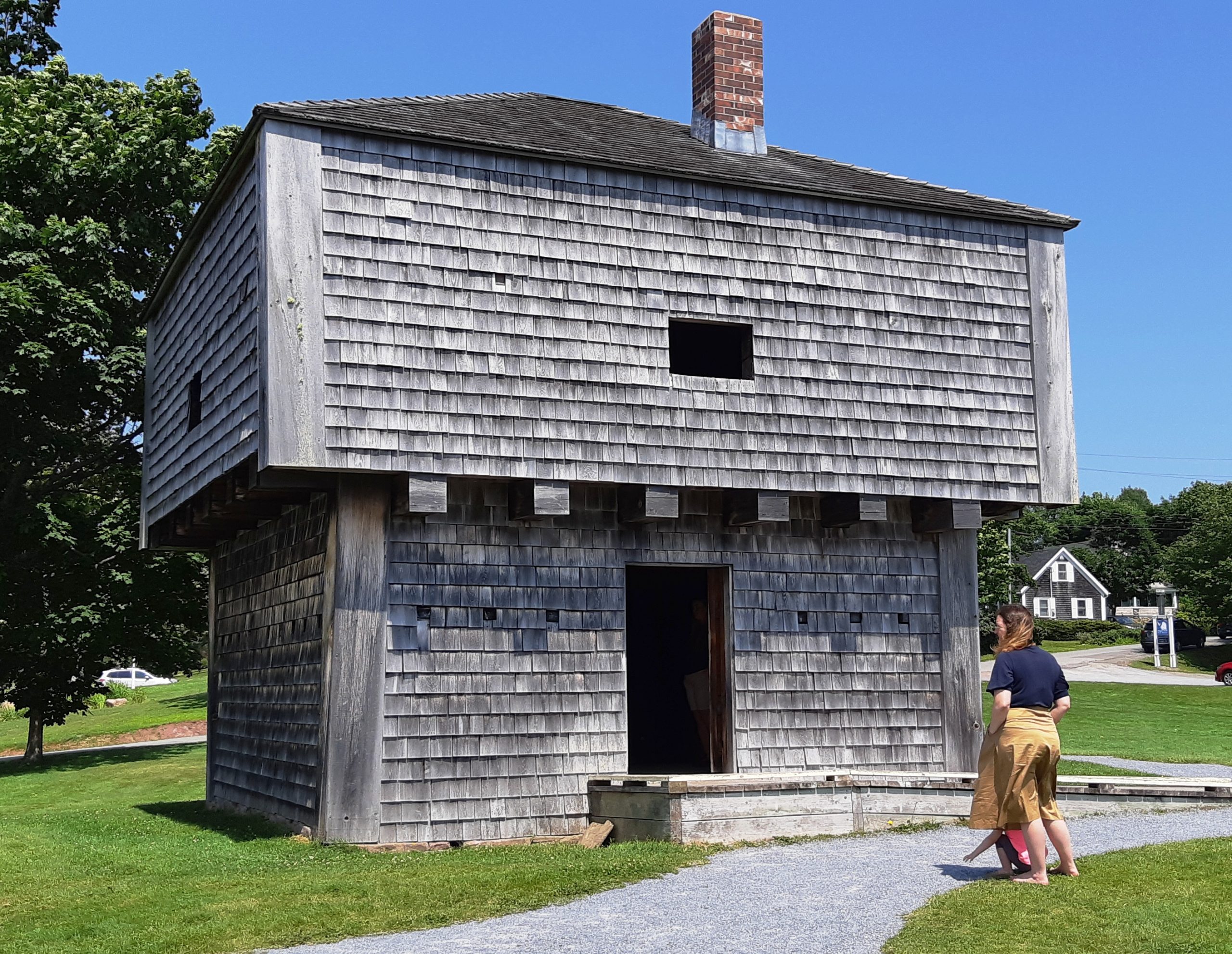
St Andrews Blockhouse National Historic Site
This blockhouse and gun battery, dating from the War of 1812, protected the border community of St Andrews from the threat of invasion from the nearby United States. This was one of the three blockhouses built at the expense of the local public minded citizens, chiefly Robert Pagan and Christopher Scott. Located at 23 Joe’s Point Road, it is a National Historic Site with a plague from the Historic Sites & Monuments Board of Canada.
Joe’s Point Blockhouse
Lieutenant Colonel Joseph Gubbins was a British regular officer responsible for inspecting annually the New Brunswick militia. During his inspection in 1811, he expressed the view that St. Andrews was a port “of the first importance” and recommended that it be fortified. Local citizens took up the suggestion and undertook to build three new blockhouses and to refurbish Fort Tipperary at their own expense. Joe’s Point Blockhouse was one of the three new blockhouses. It was located on the St Croix River, opposite Robbinston, Maine and consisted of a blockhouse, armed with a 4-pounder gun sited on the second story, and had accommodation for 30 men. In front of the blockhouse, a 24-pounder cannon was mounted, capable of firing upon the American shore. In addition to being garrisoned during the War of 1812, it was manned during the Fenian crisis of 1866. Originally located on Joe’s Point Road, it was demolished to make way for the golf course.
Piskahegan Blockhouse
In the 1790s, a road with strategic importance was built between Fredericton and St Andrews, passing through Tracey, Piskahegan, Pleasant Ridge and Rolling Dam. In the War of 1812, to protect this important line of communications, a military blockhouse was built at Piskahegan, 52 km from St Andrews and 69 km from Fredericton. The blockhouse was constructed at the end of the Pomeroy Bridge, on the east bank of the Magaguadavic River, south of the road, on a little hill with a commanding view of the surrounding area. It was completed on 18 June 1812. There was a formal inspection of the site conducted on 21 November 1814. The properties of early settlers by the names of Daniel Lee, Charles Cox, Mary Ann Pomeroy and Alexander F. Milne bordered the Blockhouse. George Von Gereau lived across the river from it. Local history says that blacksmith David Stewart set up business in the area to service the needs of the blockhouse garrison. The blockhouse remained standing for several years after 1814.
(Author Photo, 30 July 2015)
(Author Photos, 29 July 2019)
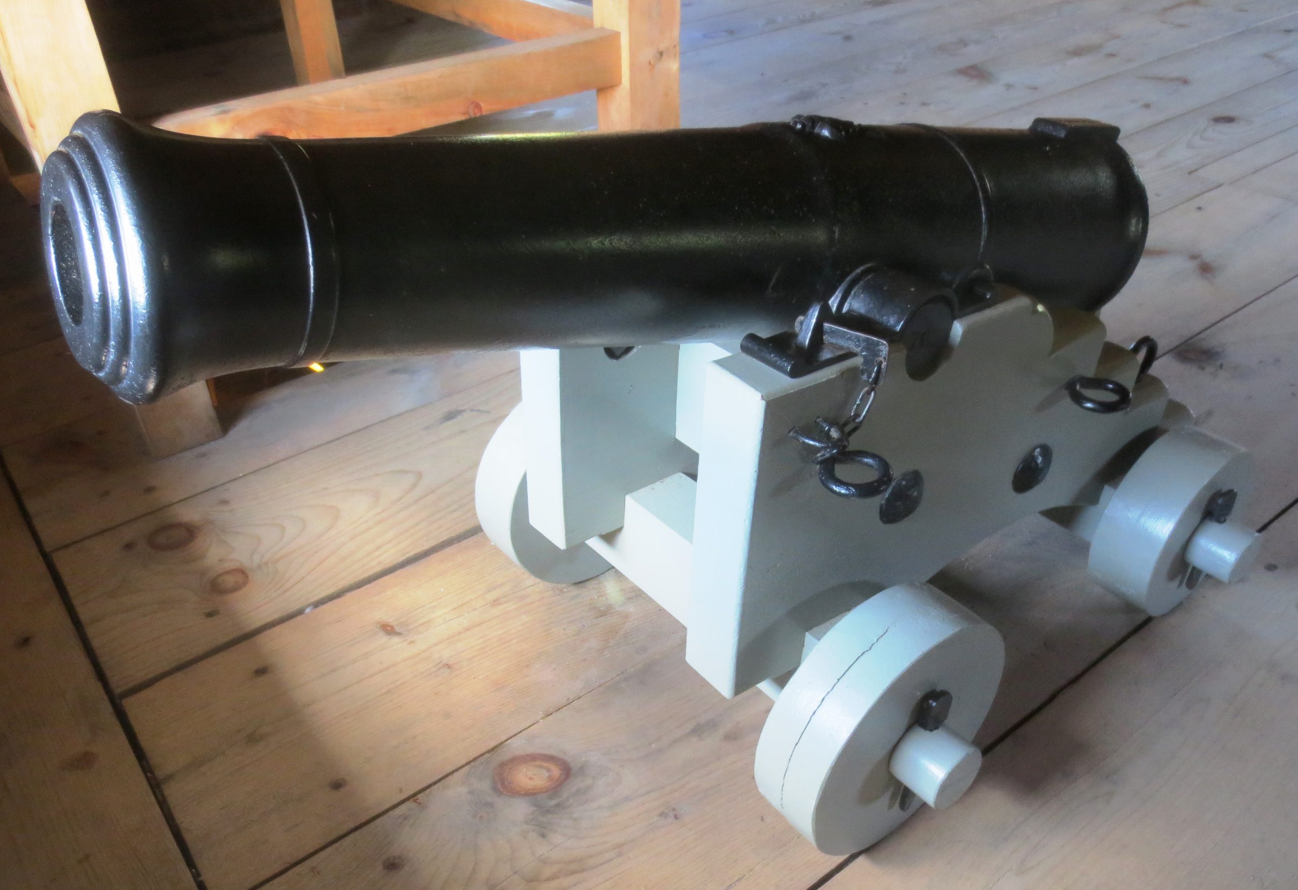
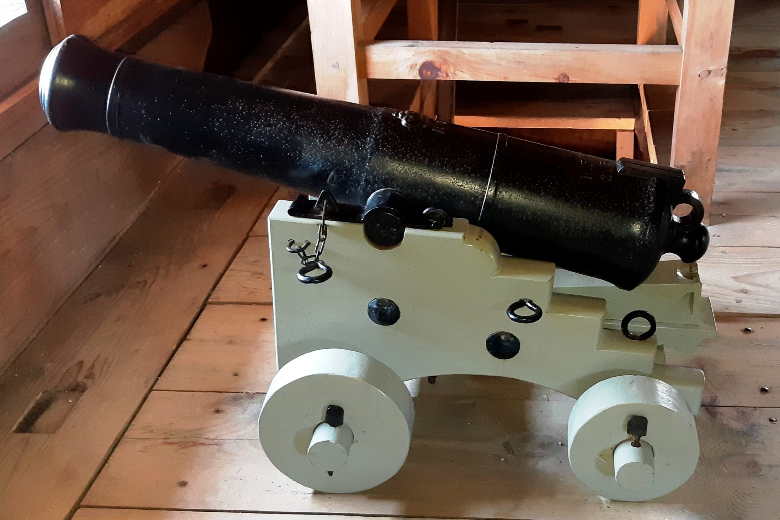
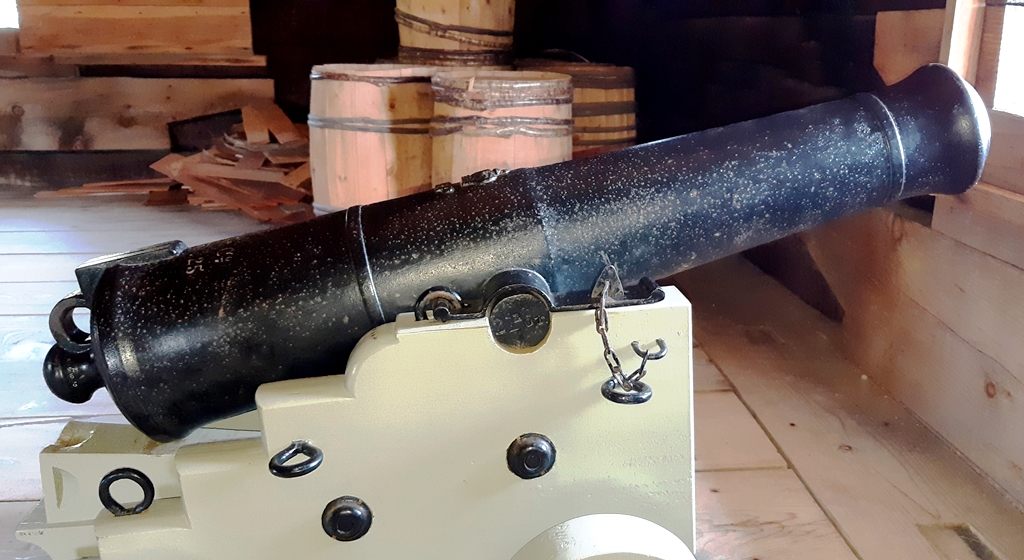
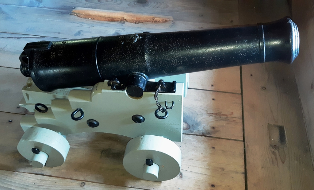
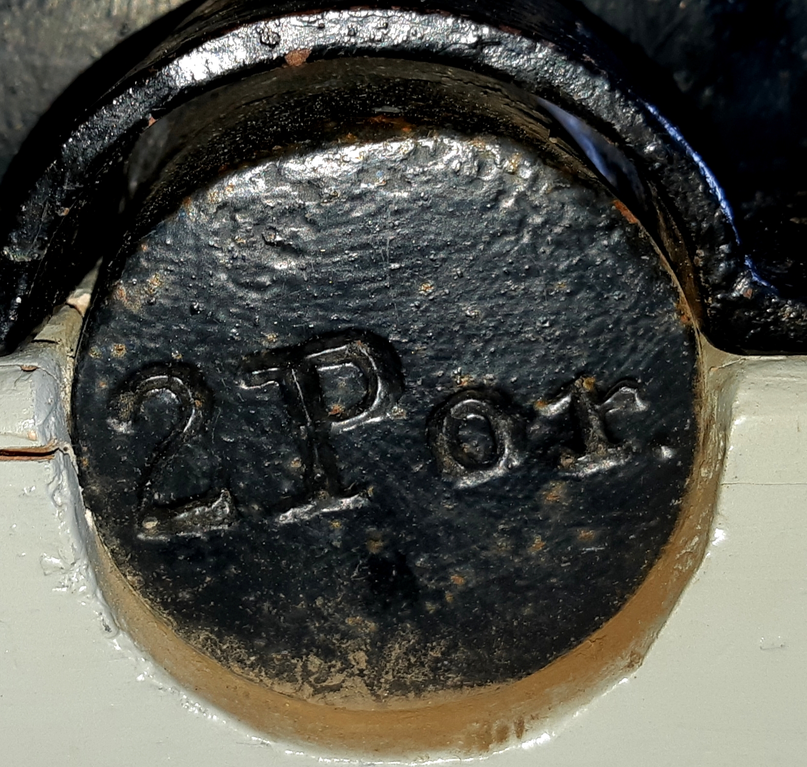
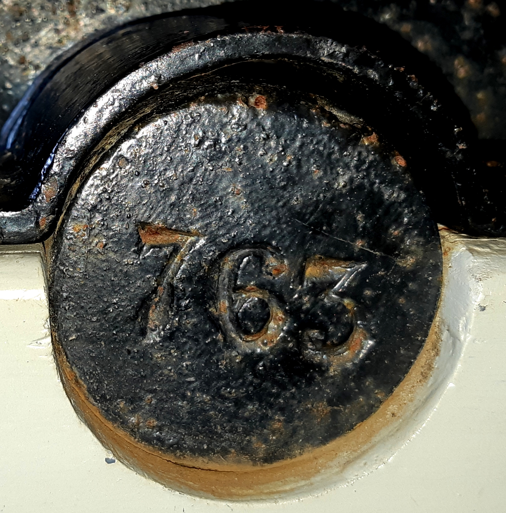
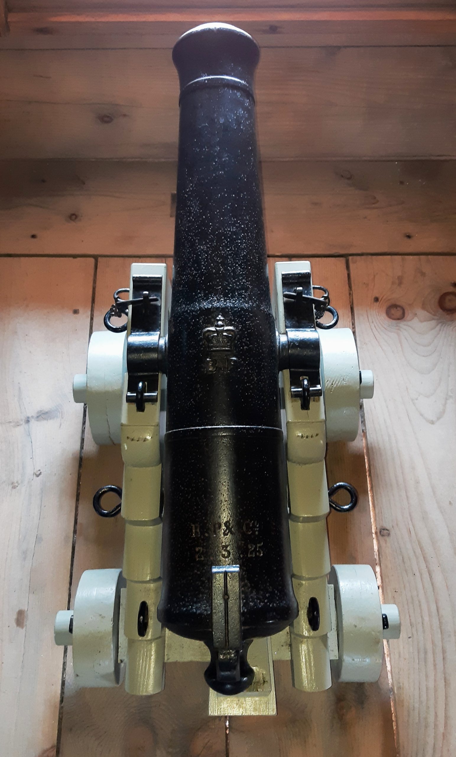
Cast Iron 2-pounder 2-cwt Smoothbore Muzzleloading Gun with Blomefield-pattern breeching ring, weight 2-3-25 (333 lbs), BP & Co., 2 Por) on the left trunnion, (Serial No. 763) on the right trunnion, (mounted on a naval gun carriage, second floor of the Block House facing West.
William Bailey was an iron founder in Bankside in the 1820s. By 1835 Bailey had taken on premises at Gun Wharf in Wapping and the following year the firm became Bailey, Pegg and Company. By 1844 their main works were Brierley Hill, in Staffordshire, although they maintained a London warehouse. As late as the 1890s, when they were increasingly concentrating on ironwork for gas and water works and ballast, they still supplied cannon shot and shells. They survived well into the twentieth century, possibly the last gunfounders in Britain. Bailey, Pegg and Company offered merchant guns and gunnades in small calibres for private customers and larger calibre guns for foreign governments and usually date from the second quarter of the 19th century. You can find their guns right round the world. The initials BP & Co are usually engraved on the top of the gun barrel, often with a crowned P and number, indicating the calibre, rather than on the trunnion face. it is occasionally found cast on the barrel. It is a very common mark. (Ruth Rhynas Brown)
(Author Photos, 21 July 2020)
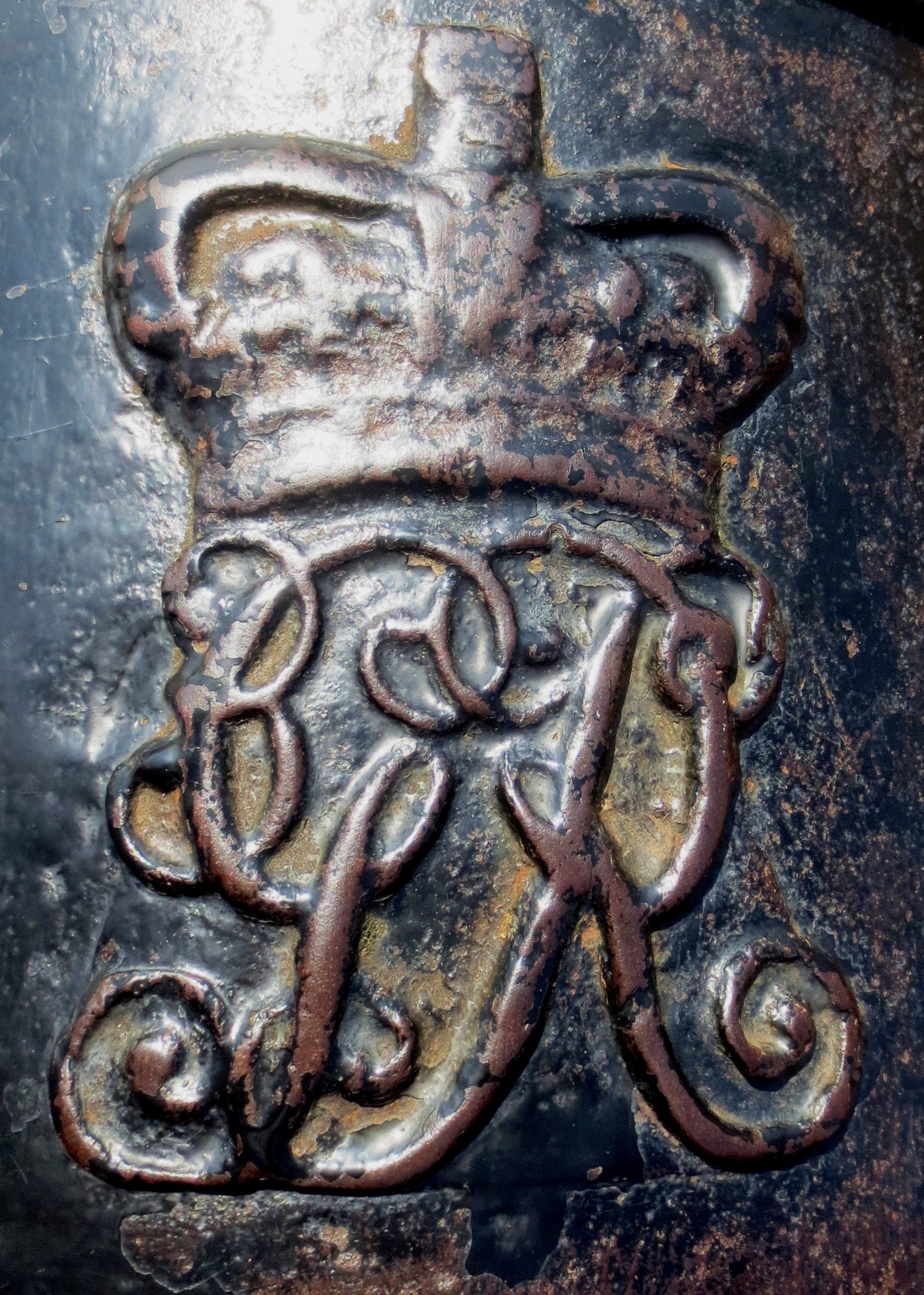
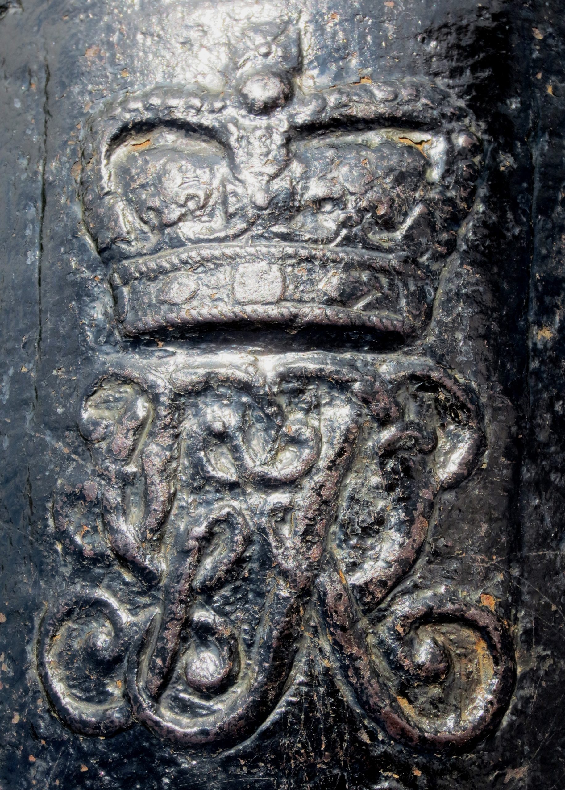
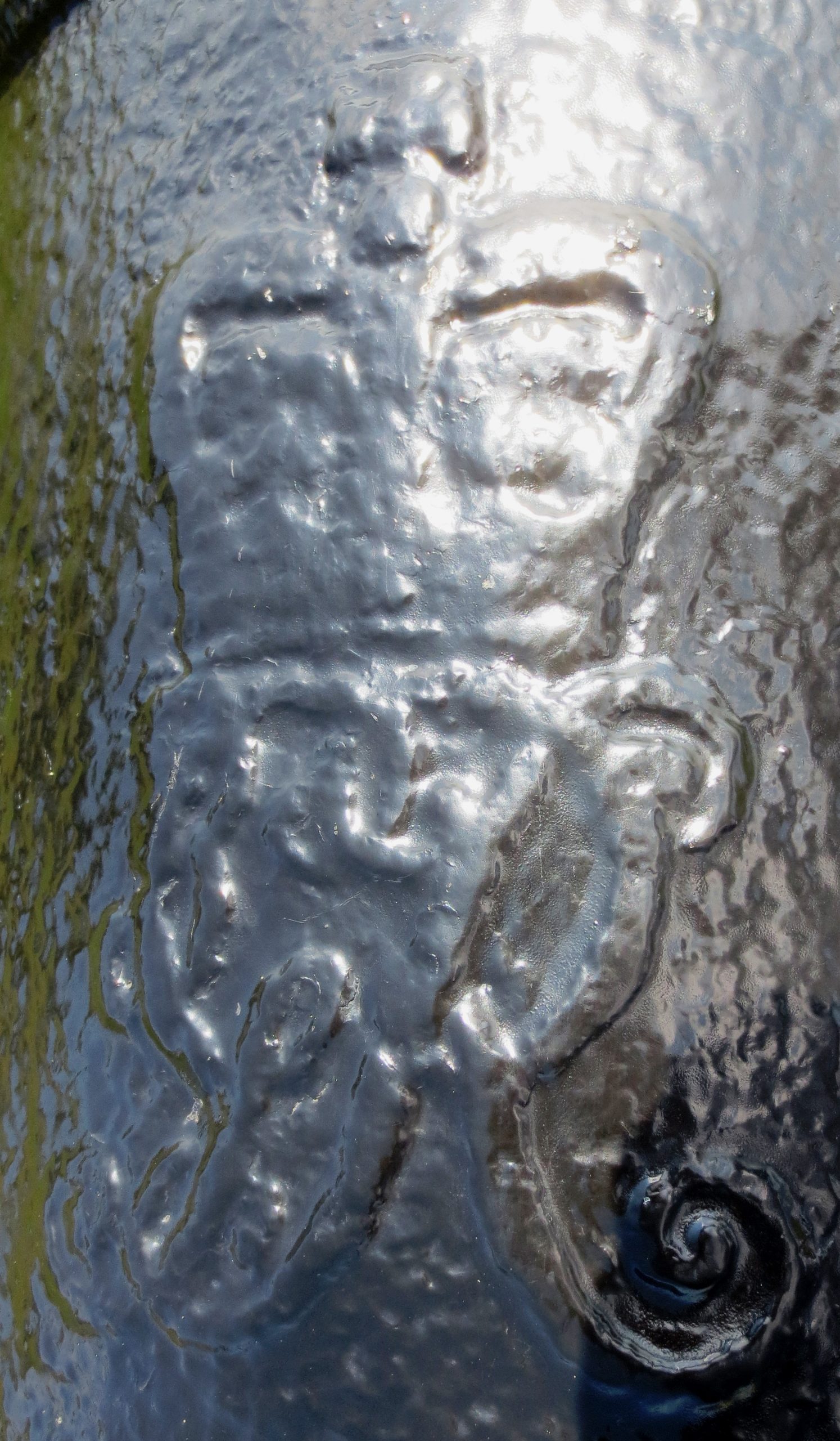
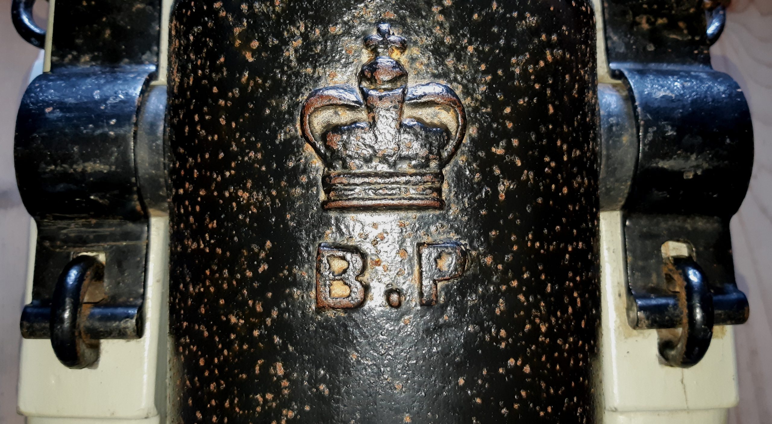
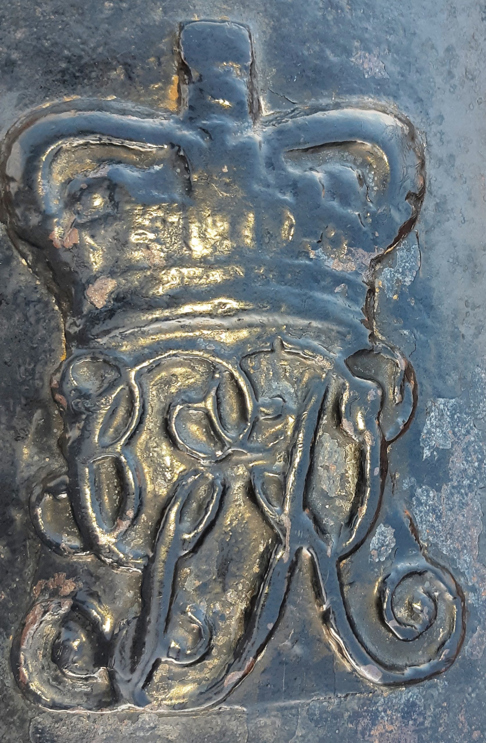
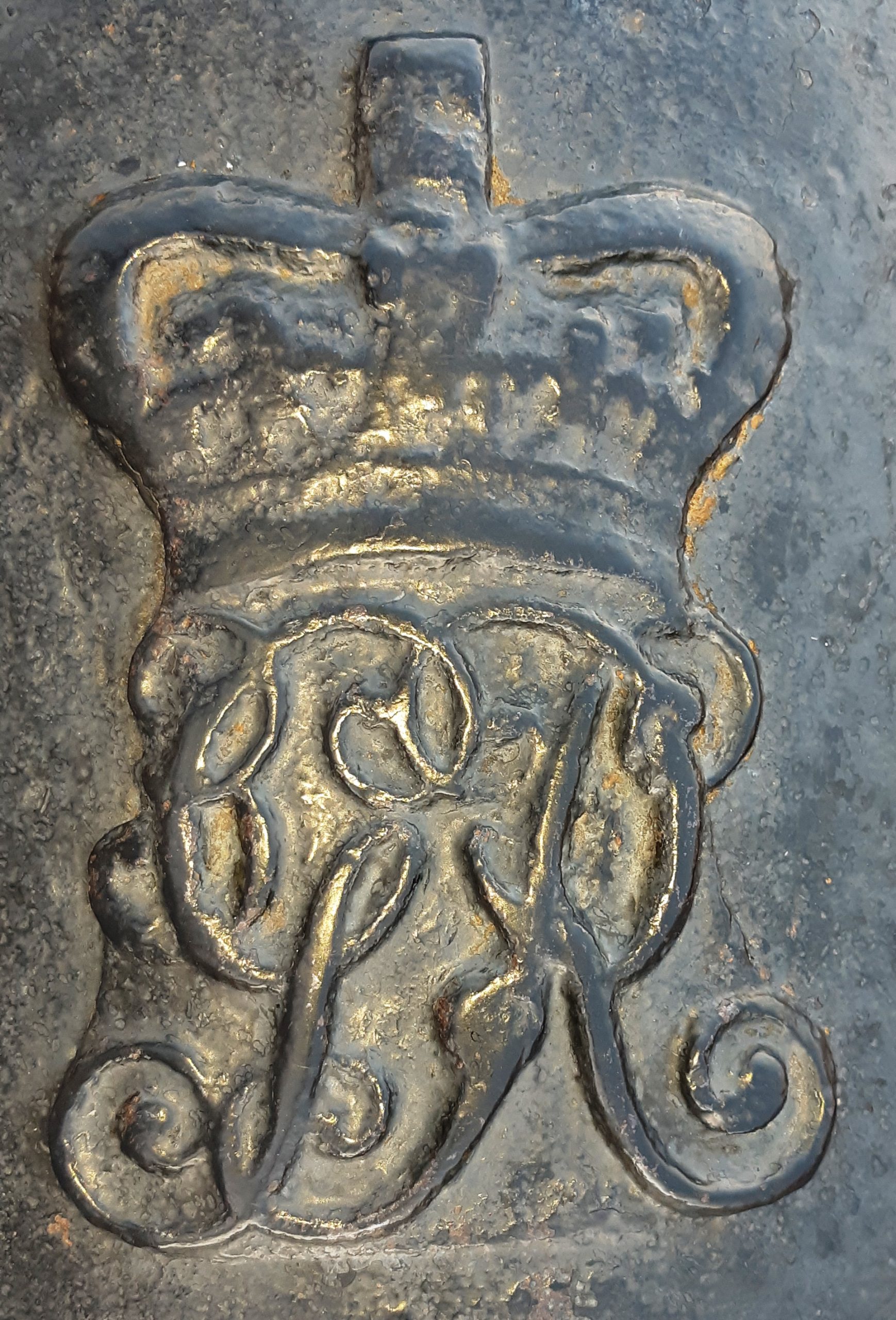
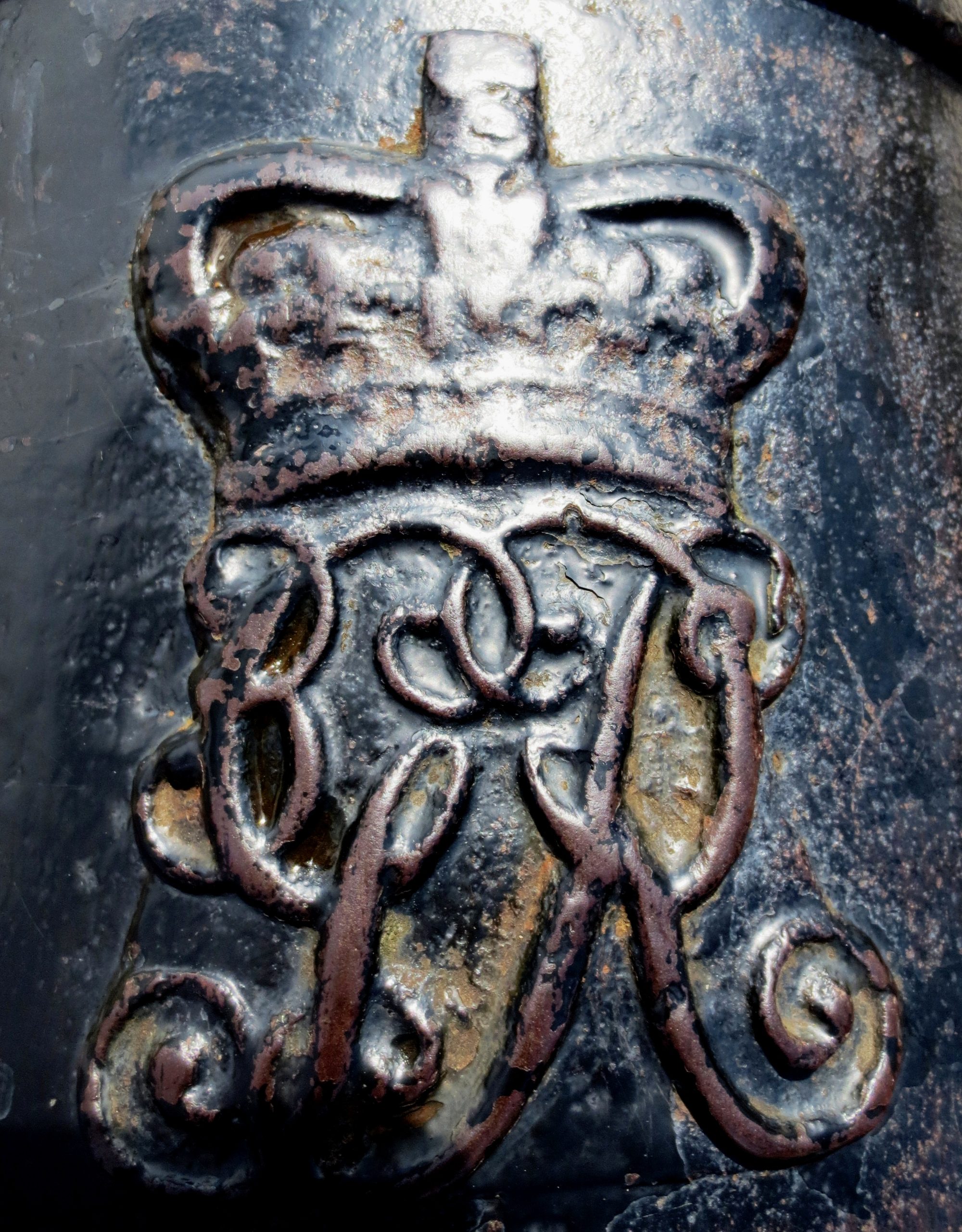
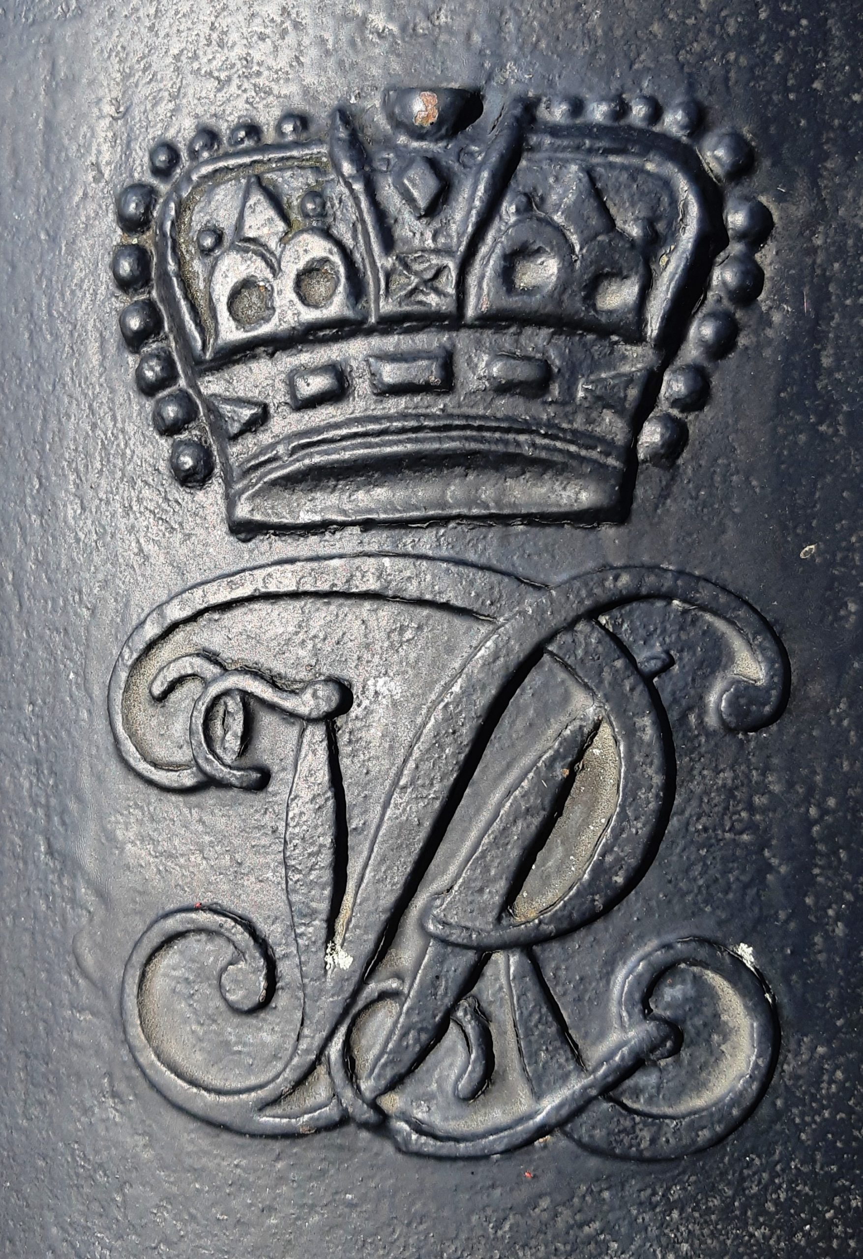
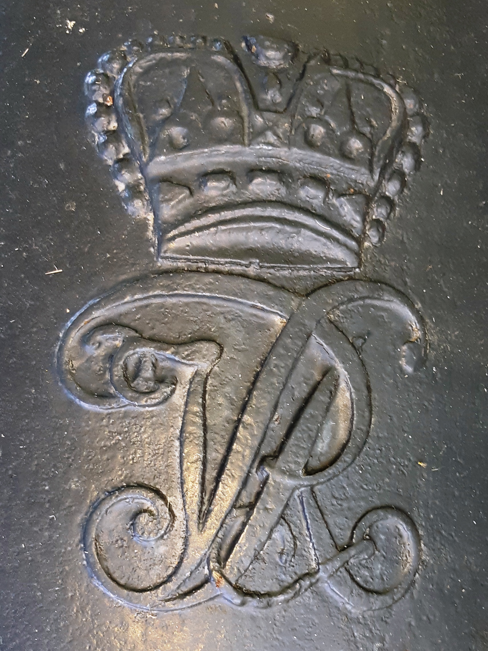
The mongram of King George III on the barrel can be found on all British cannons manufactured between 1760 and 1820.
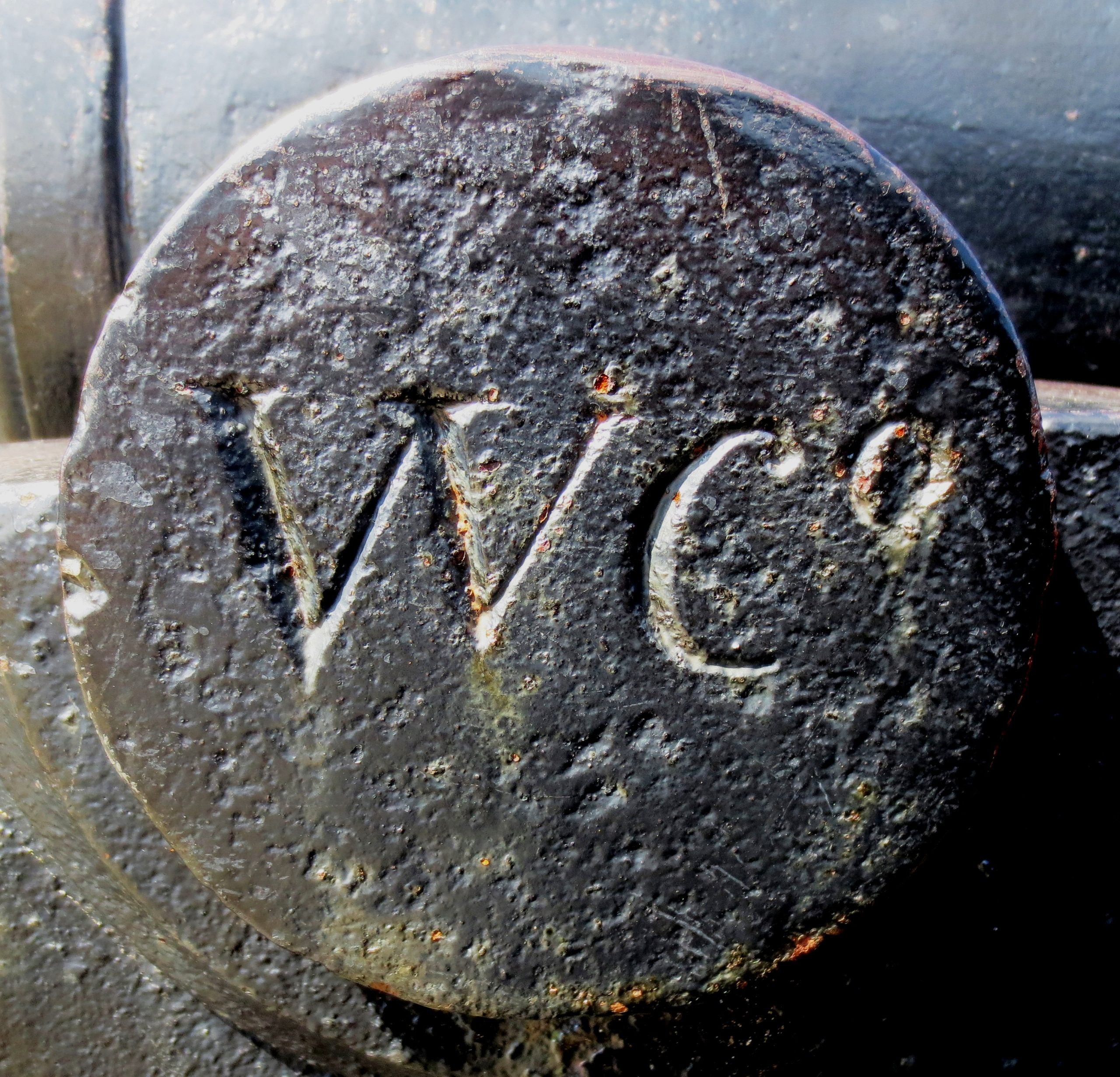
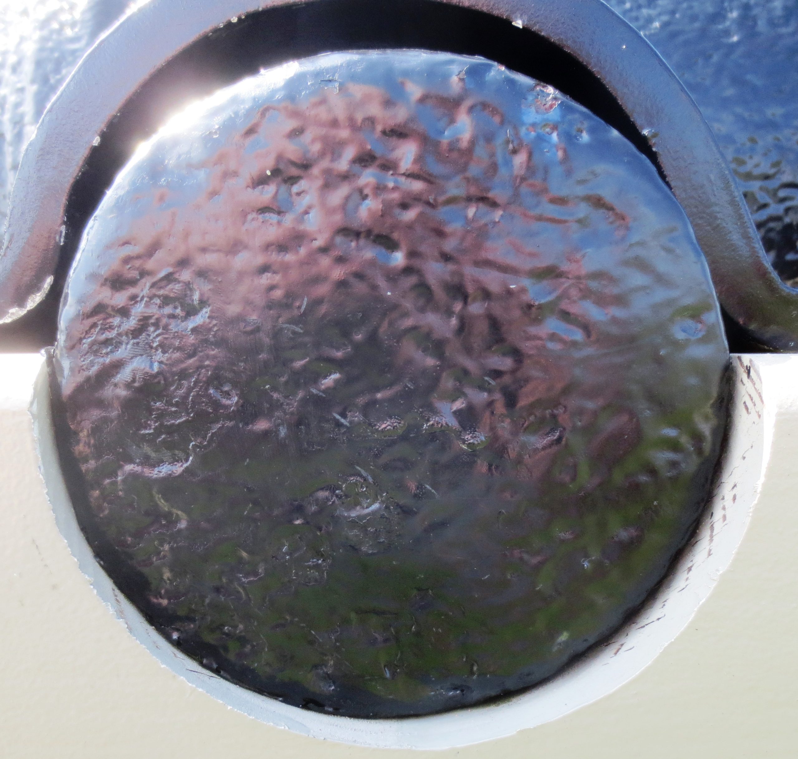
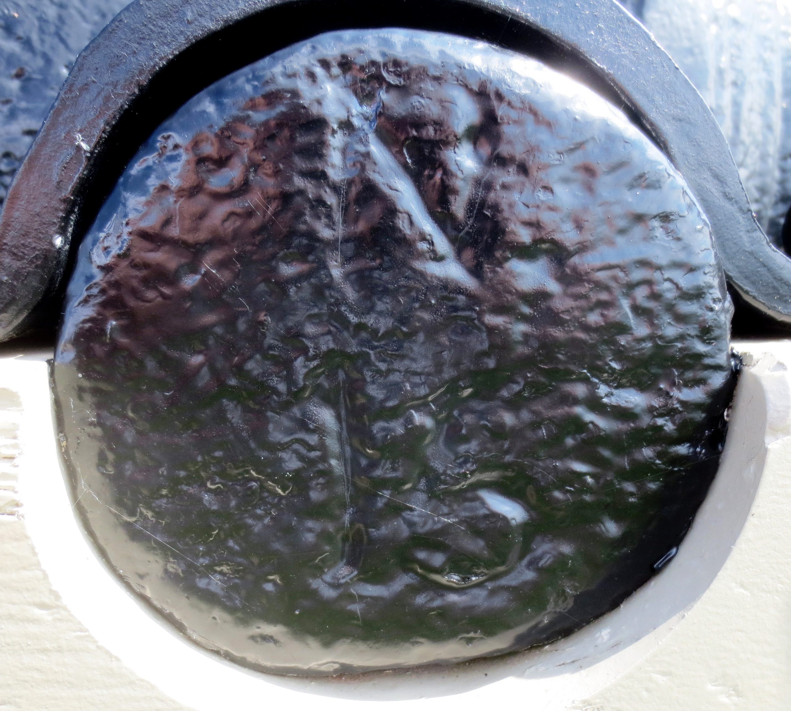
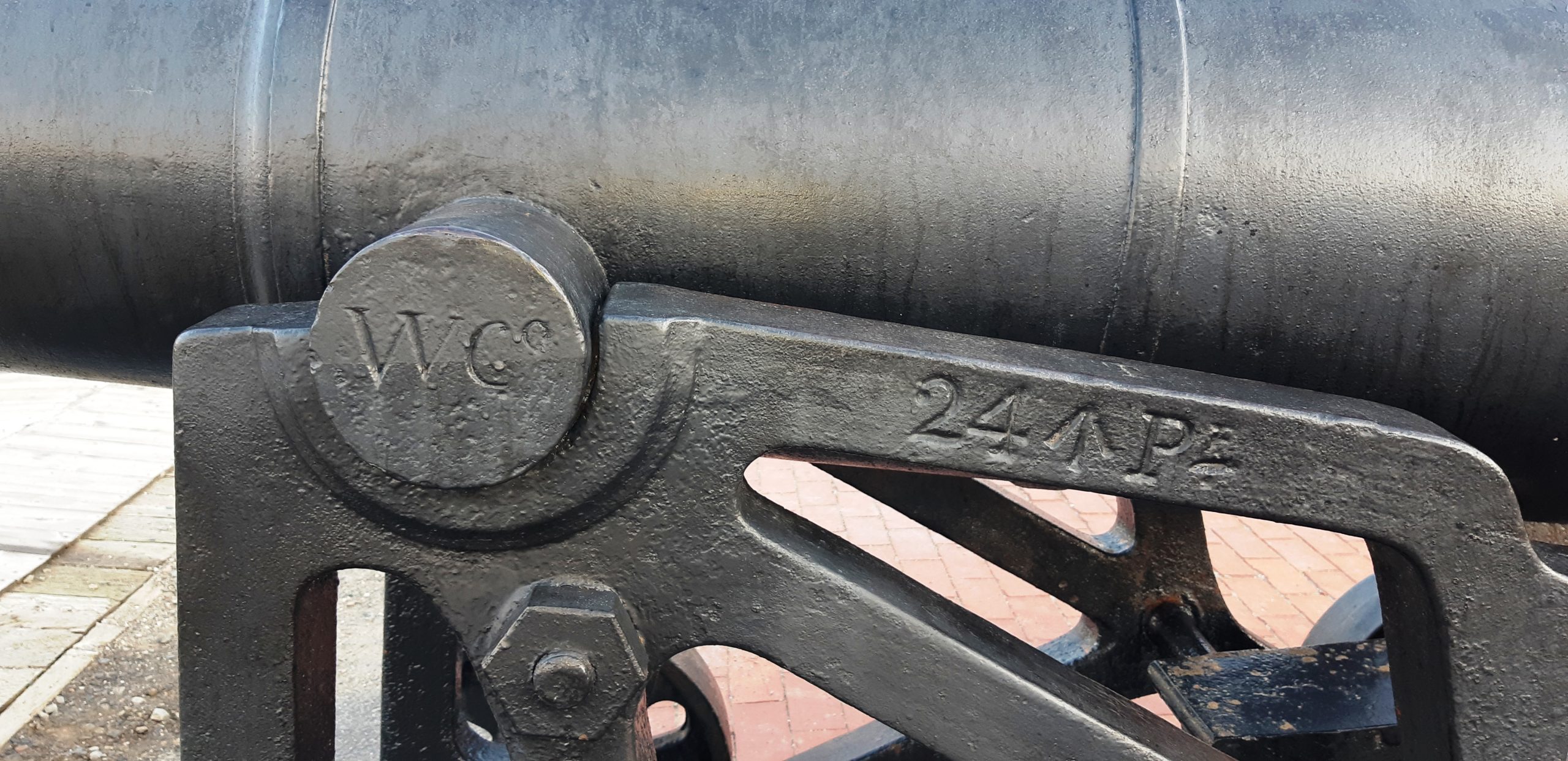
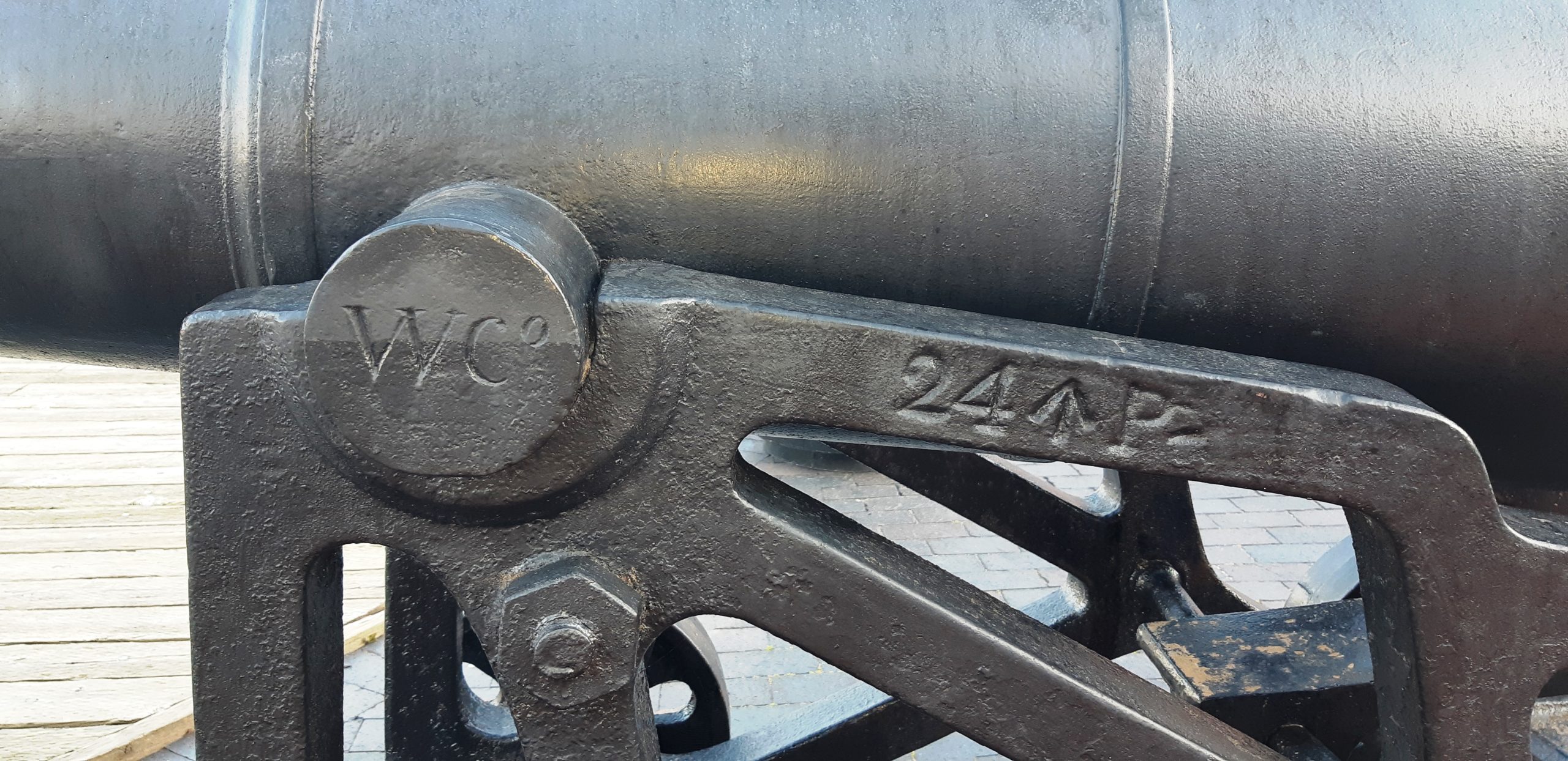
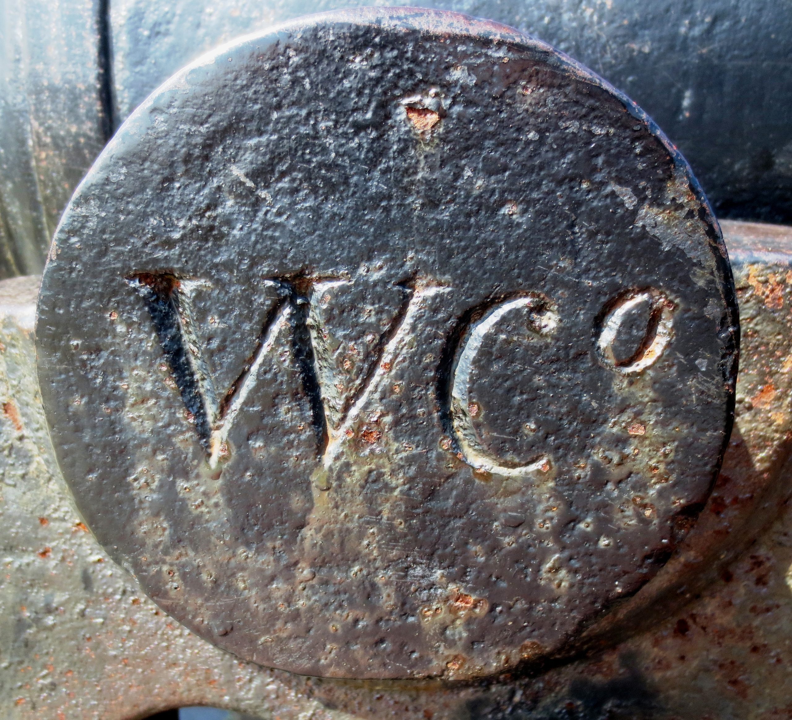
WC on the left trunnion indicates that these cannons were made by Samuel Walker & Company of Rotherham, England.
(Author Photos 28 July 2019)
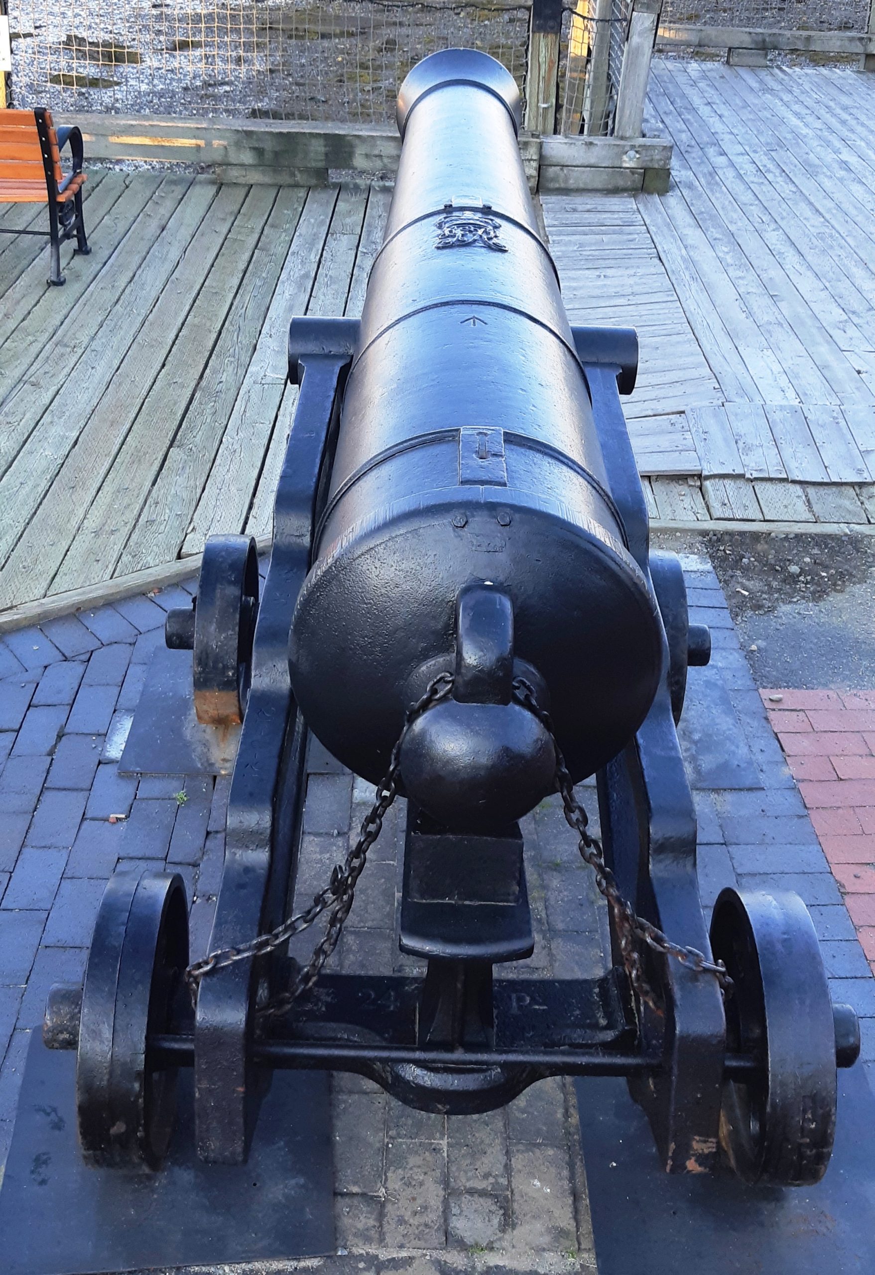
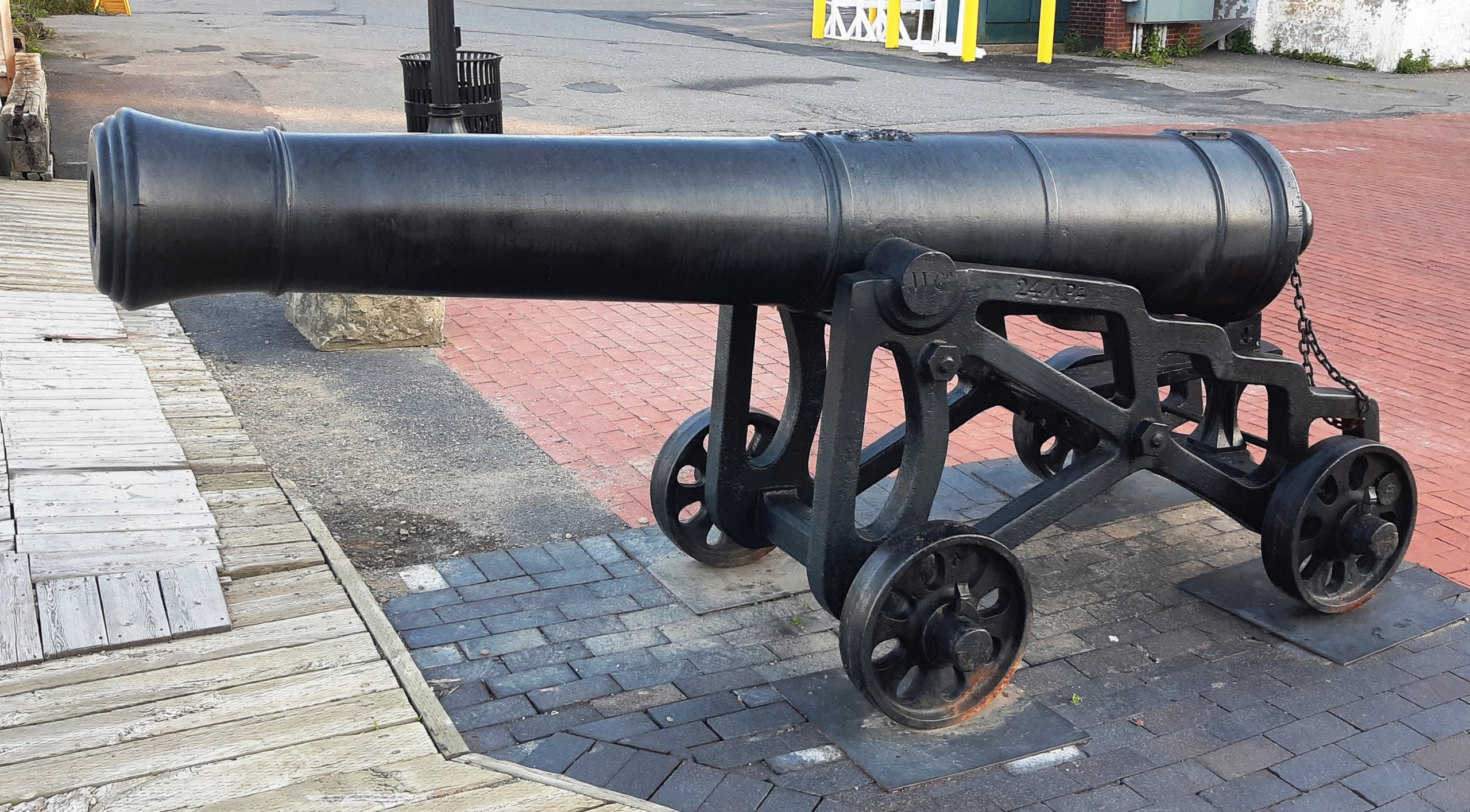
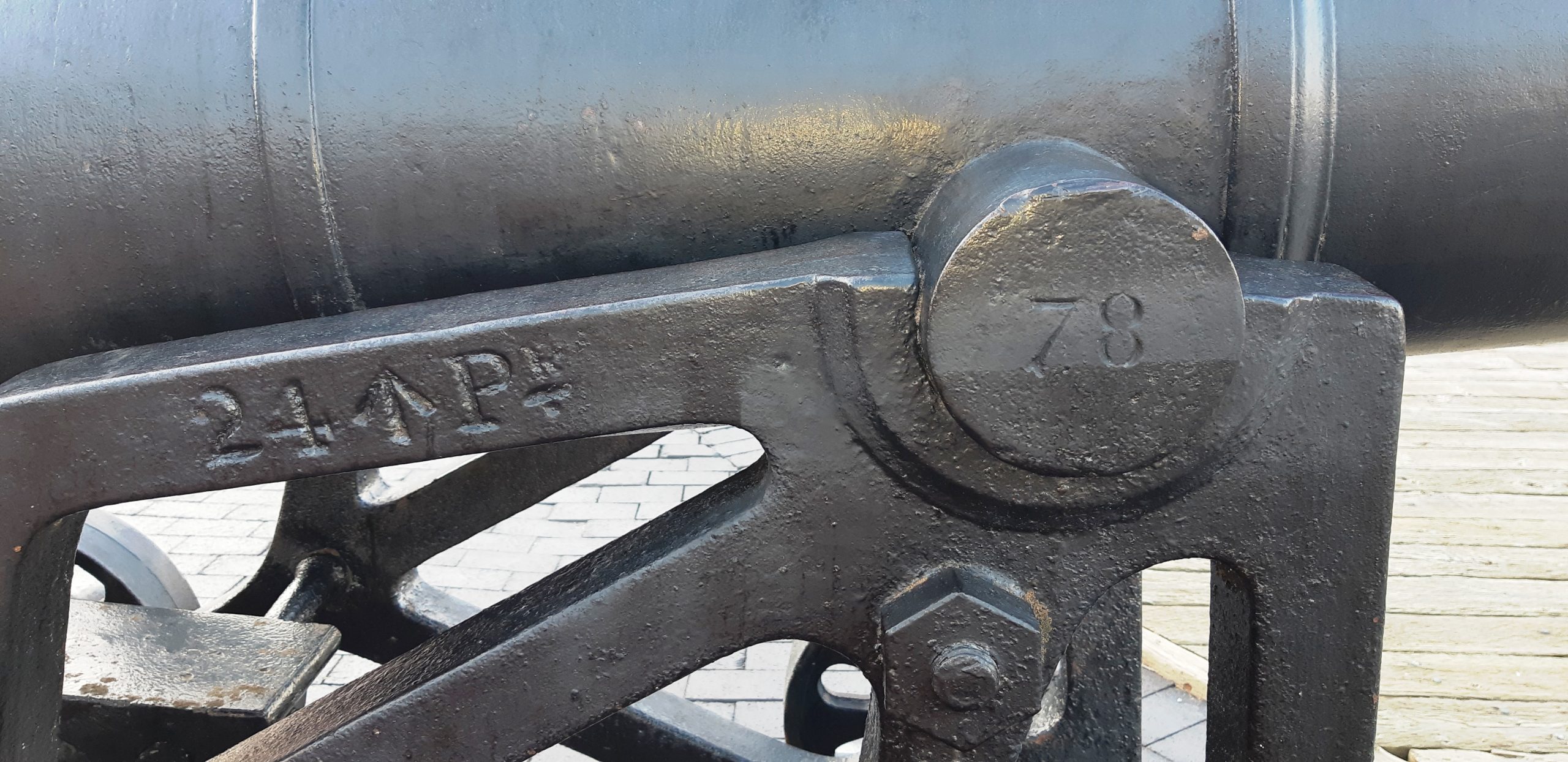
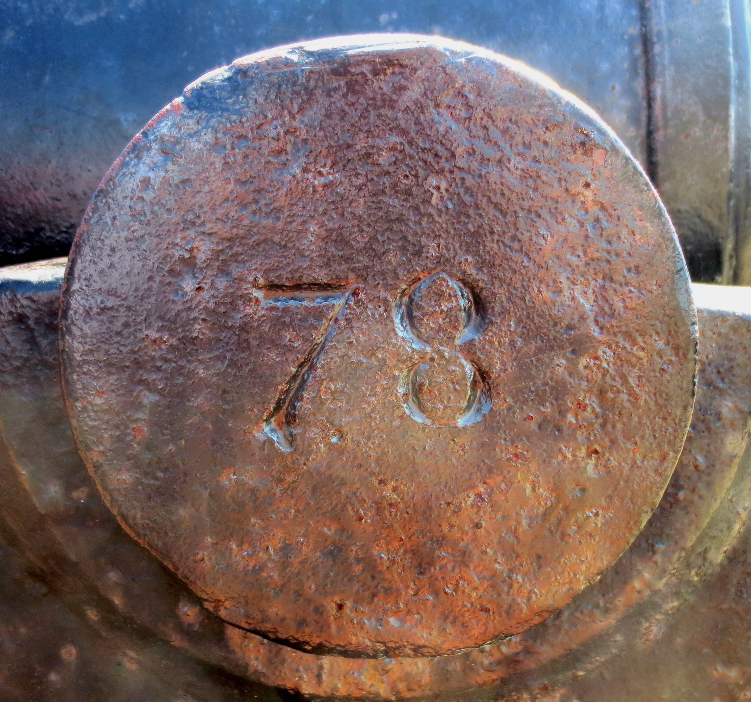
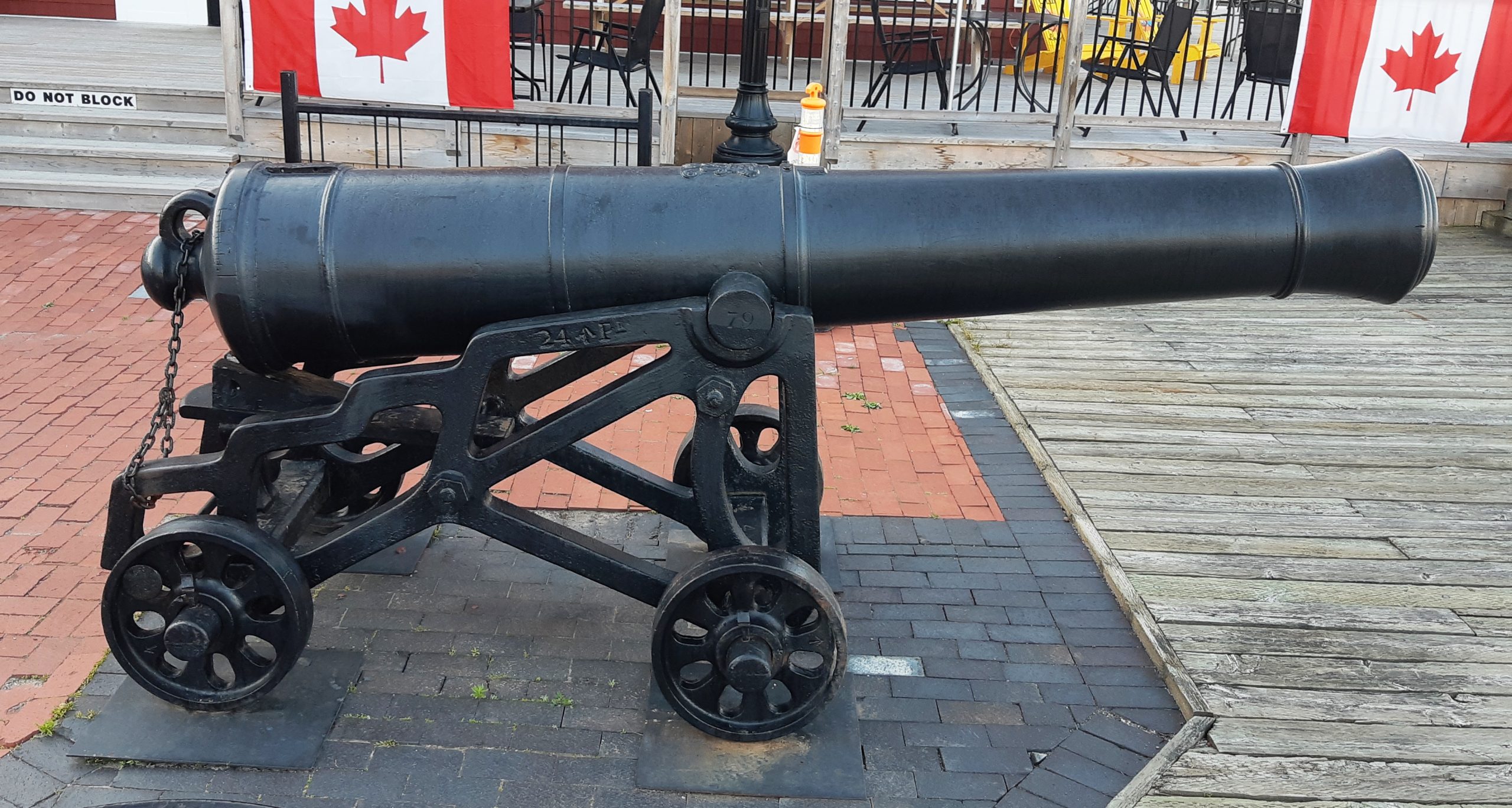
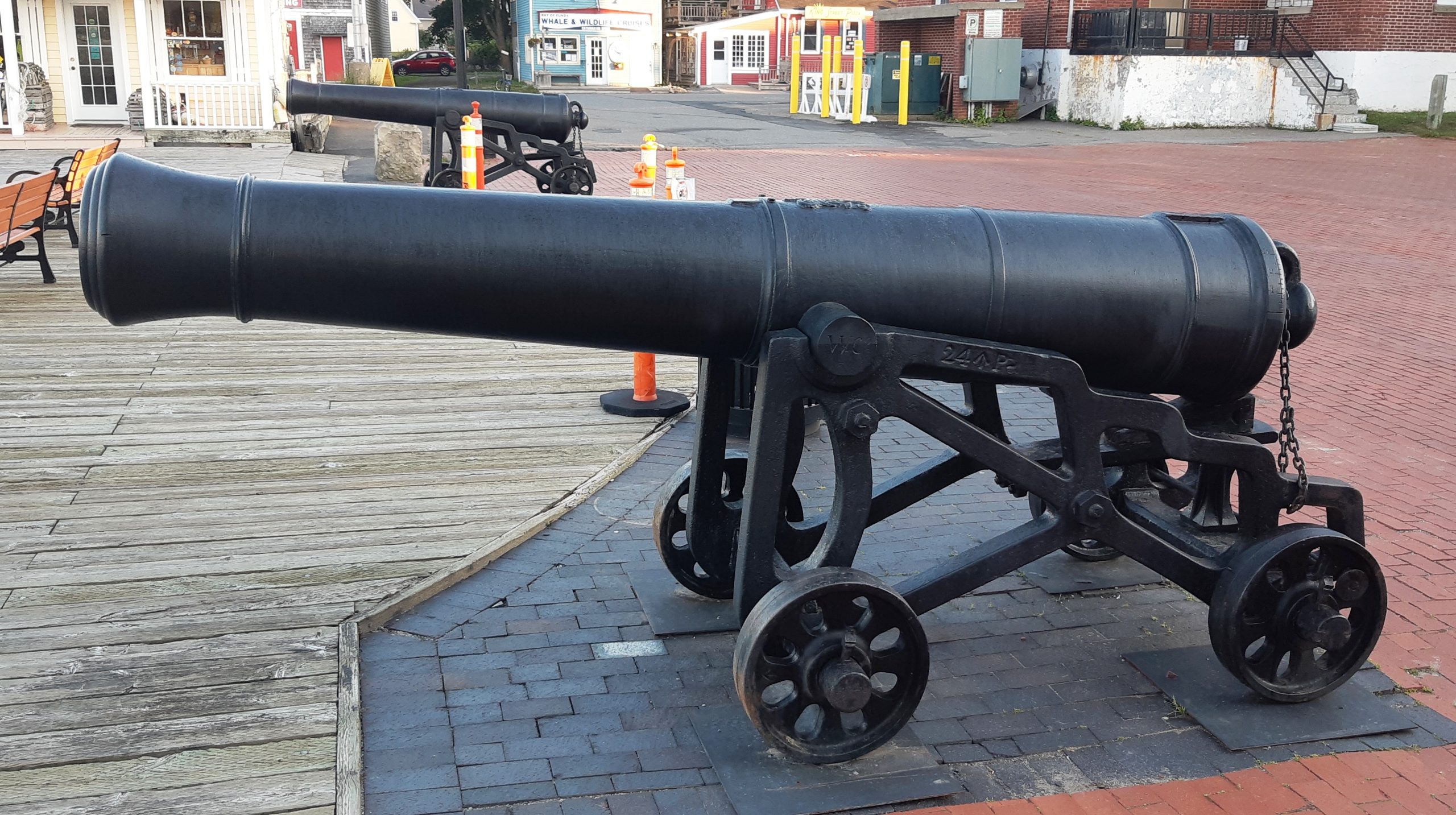
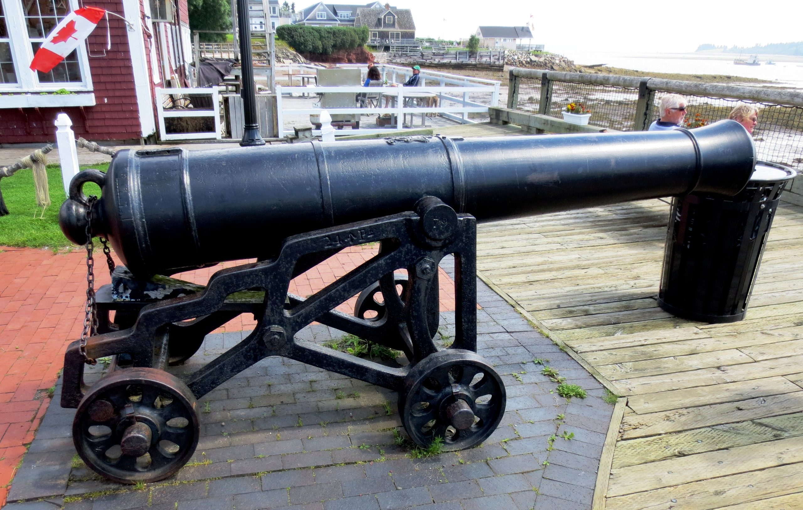
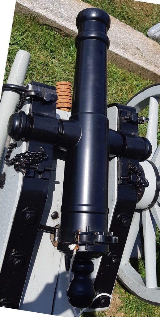
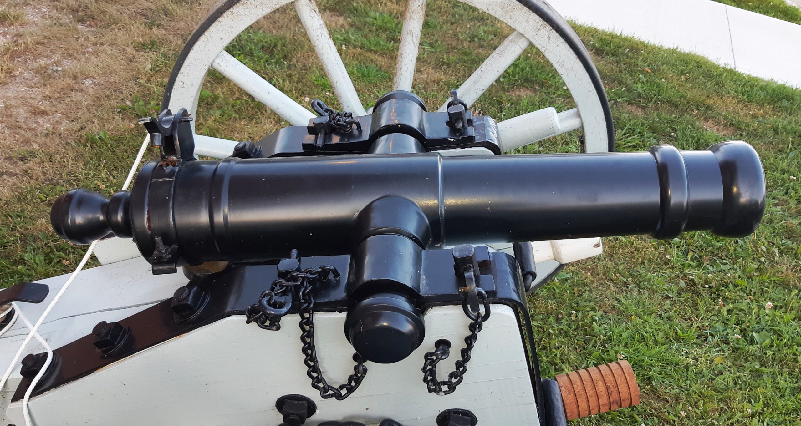
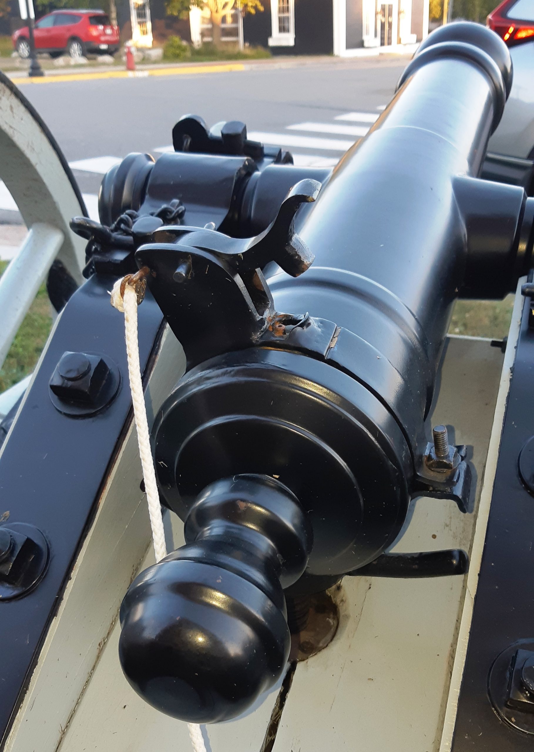
Blomefield Cast Iron 24-pounder 50-cwt Smoothbore Muzzleloading Gun, weight 50-0-14 (5,614 lbs), Samuel Walker & Company of Rotherham, England (WCo) on left trunnion, (Serial No. 78) on right trunnion, ca. 1800-1820, King George III cypher, broad arrow mark, mounted on an iron garrison carriage, facing the waterfront in Market Square, across from the Town Hall. No. 1 of 2.
These cannons were once located at the West Blockhouse, now called the St. Andrews Blockhouse National Historic Site. During restoration of the blockhouse in 1967, they were placed in front of Hall Town, and later moved to their current location.
(Author Photos, 21 July 2020)
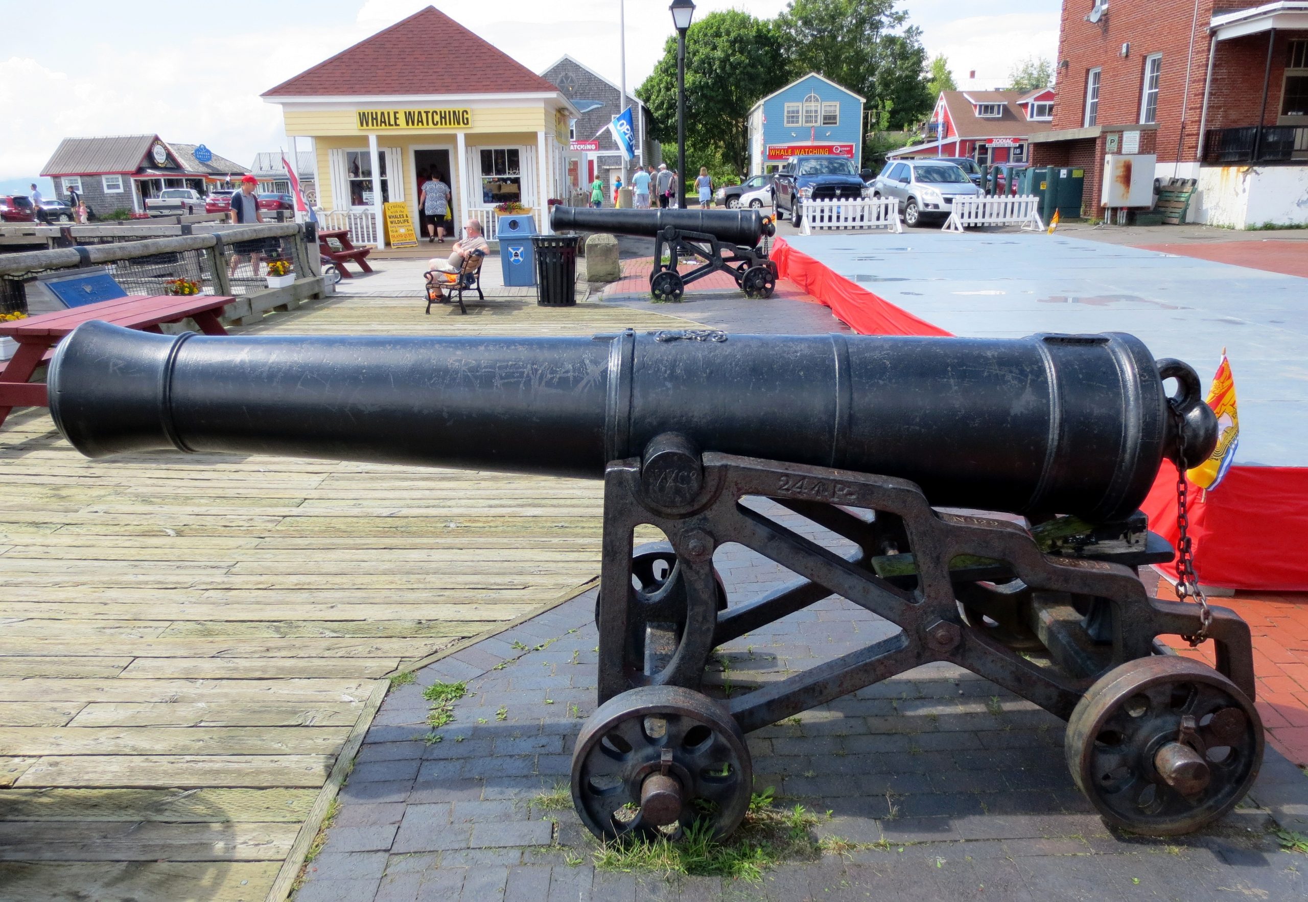
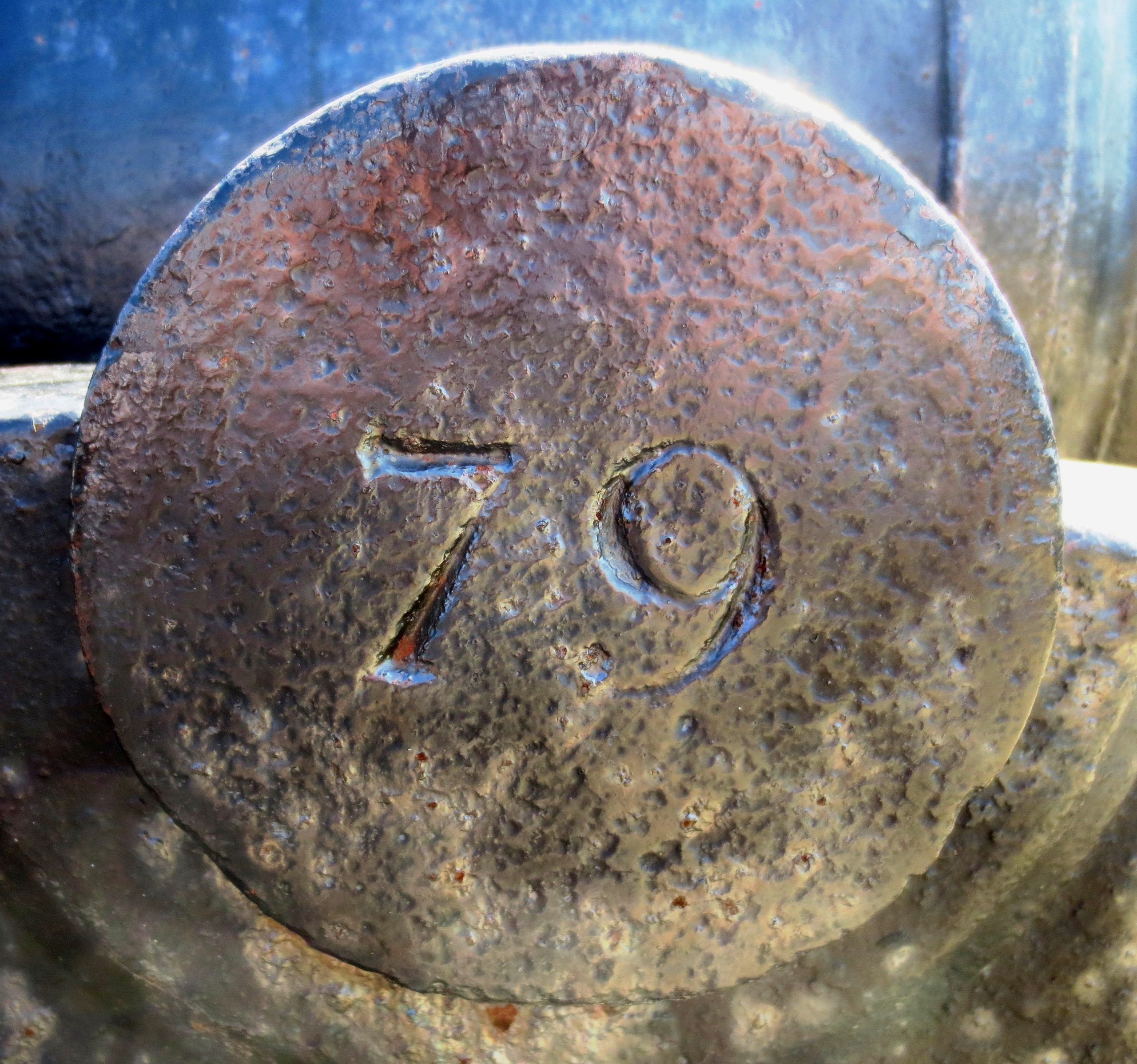
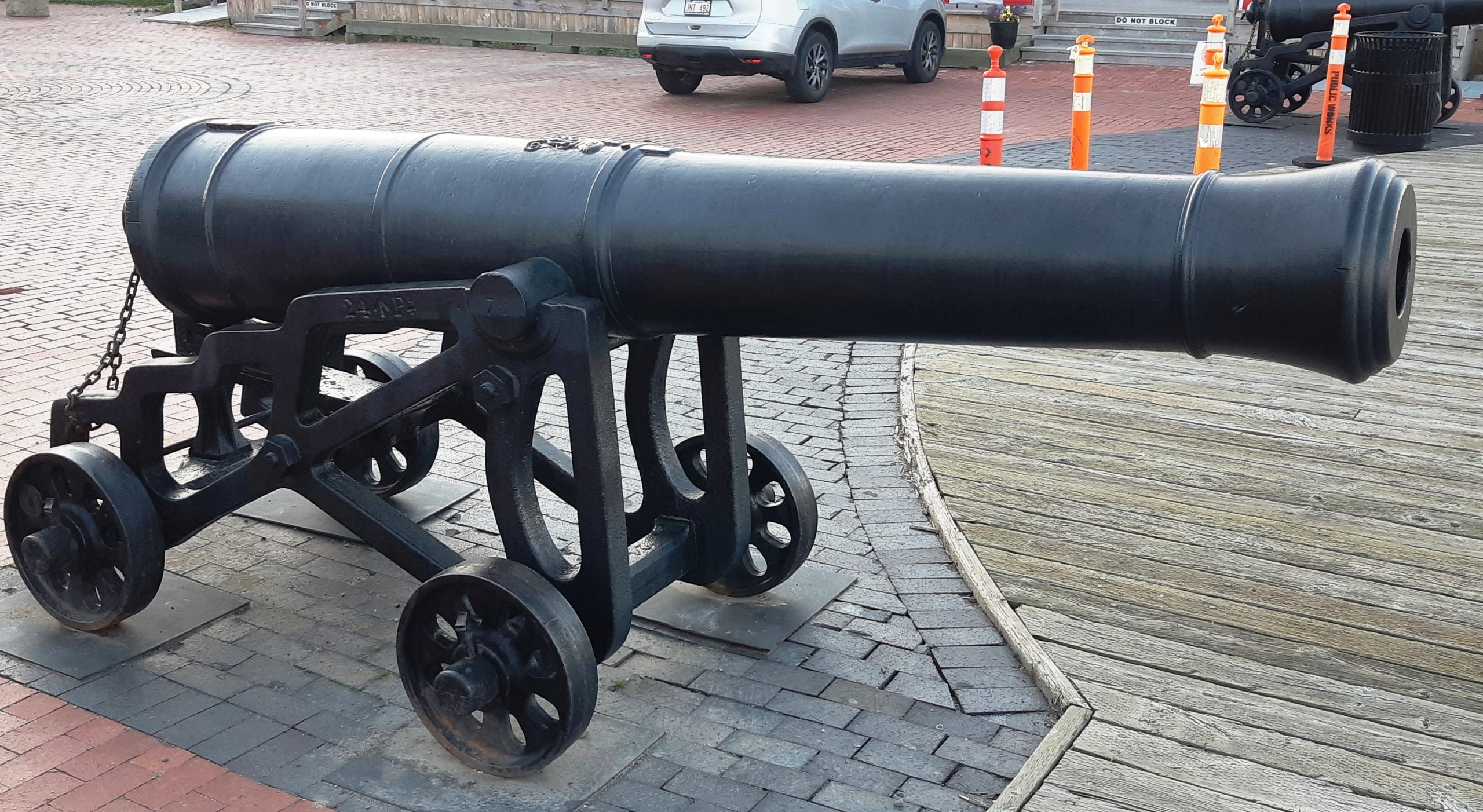
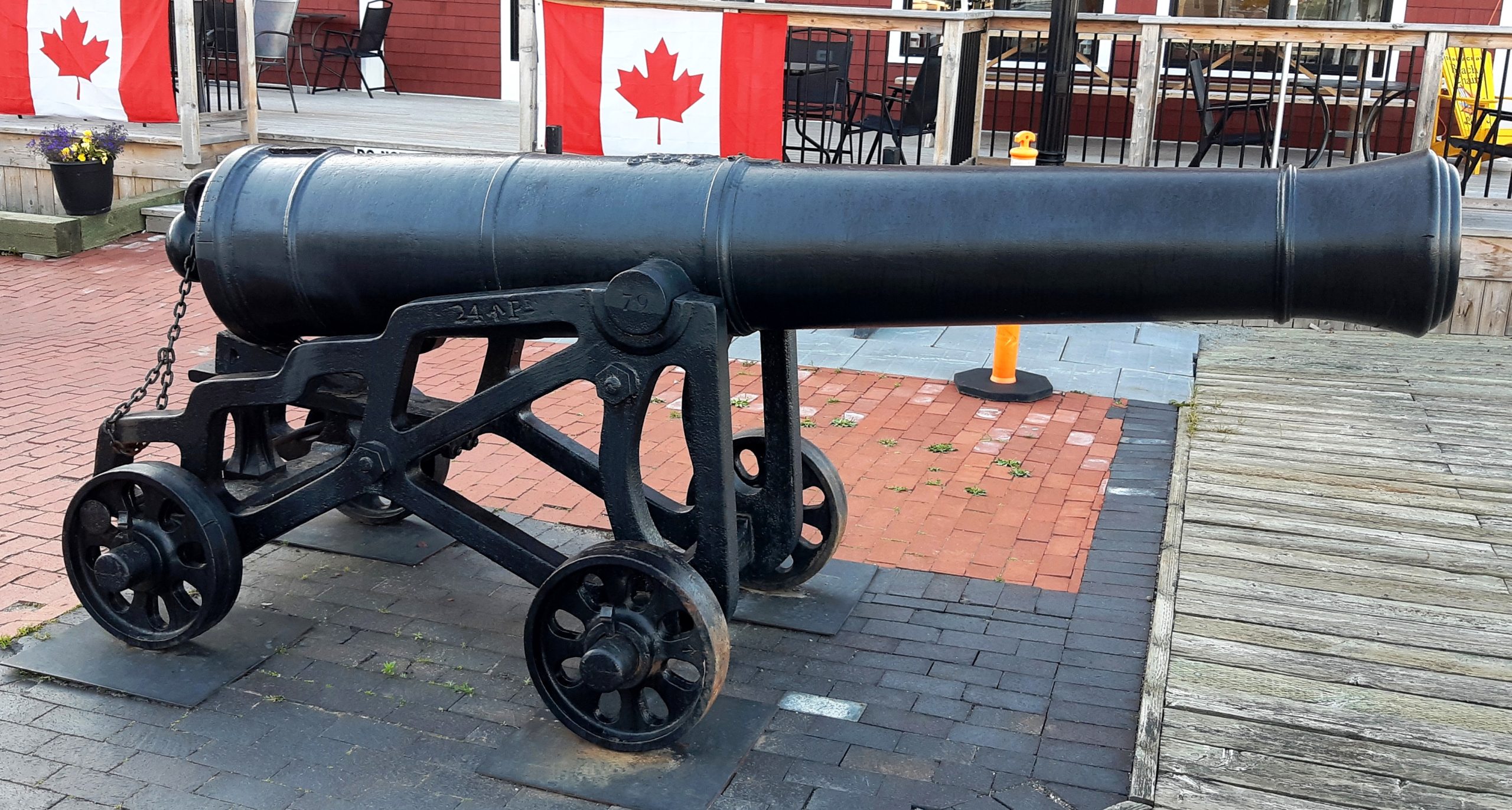
Blomefield Cast Iron 24-pounder 50-cwt Smoothbore Muzzleloading Gun, weight 50-0-14 (5,614 lbs), Samuel Walker & Company of Rotherham, England (WCo) on left trunnion, (Serial No. 79) on right trunnion, facing the waterfront across from the Town Hall. No. 2 of 2.
Fort Tipperary
Fort Tipperary was built in 1808 during the threat of war between Great Britain and the United States over the Chesapeake Affair. It is a star-shaped defensive work located on a strategic hill, which commanded both the Town of St Andrews, the harbour, and part of the adjacent country. The original plan was to build a large redoubt on the site, but it was never completed. During the War of 1812, the Fort consisted of a blockhouse capable of housing 70 men, barracks, a stone bomb-proof magazine, storehouses, a guard room, and a fuel yard. It was armed with three 18-pounder and six 12-pounder cannons. Later Fort Tipperary was garrisoned during the Fenian scare of 1866. The ramparts of the Fort still exist and have been a registered provincial historical site since 2006.
The star shaped fort consisted of a stockade on earthen ramparts that measured approximately 400 x 200 feet. The remains of Fort Tipperary currently consist of the earthworks of a star-shaped fortification located on an approximately 1.7 ha site at 69 Prince of Wales Street in the Town of St. Andrews. Four guns are currently located within its almost completely intact earthen ramparts, including two bronze 9-pounder smoothbore muzzle-loading cannons (demi-culverins) related to the War of 1812; and two cast iron 32-pounder smoothbore muzzle-loading cannons (demi-cannons) related to a re-arming of the fort in response to the Fenian Raids.
Fort Tipperary, along with three blockhouses, was planned as part of the defensive network for the important but exposed coastal St. Andrews during the war of 1812. Situated at the back of the community, Fort Tipperary had a commanding view of the settlement and the approach by sea. The War of 1812 ended and peace was restored before the fort was completed, and the garrison departed shortly after the signing of the Treaty of Ghent in 1814.
Other fortifications of the same period exist in the province, but their earthworks have not survived to the same extent as those of Fort Tipperary’s. Subsequently, the fort was rearmed during the threat of the Fenian Raids. The site was later used by the Provincial militia for training. In 1901, the barracks were torn down. (Source: Province of New Brunswick, Department of Wellness, Culture and Sport, Heritage Branch, Site File # 64)
(Author Photos, 21 July 2020)
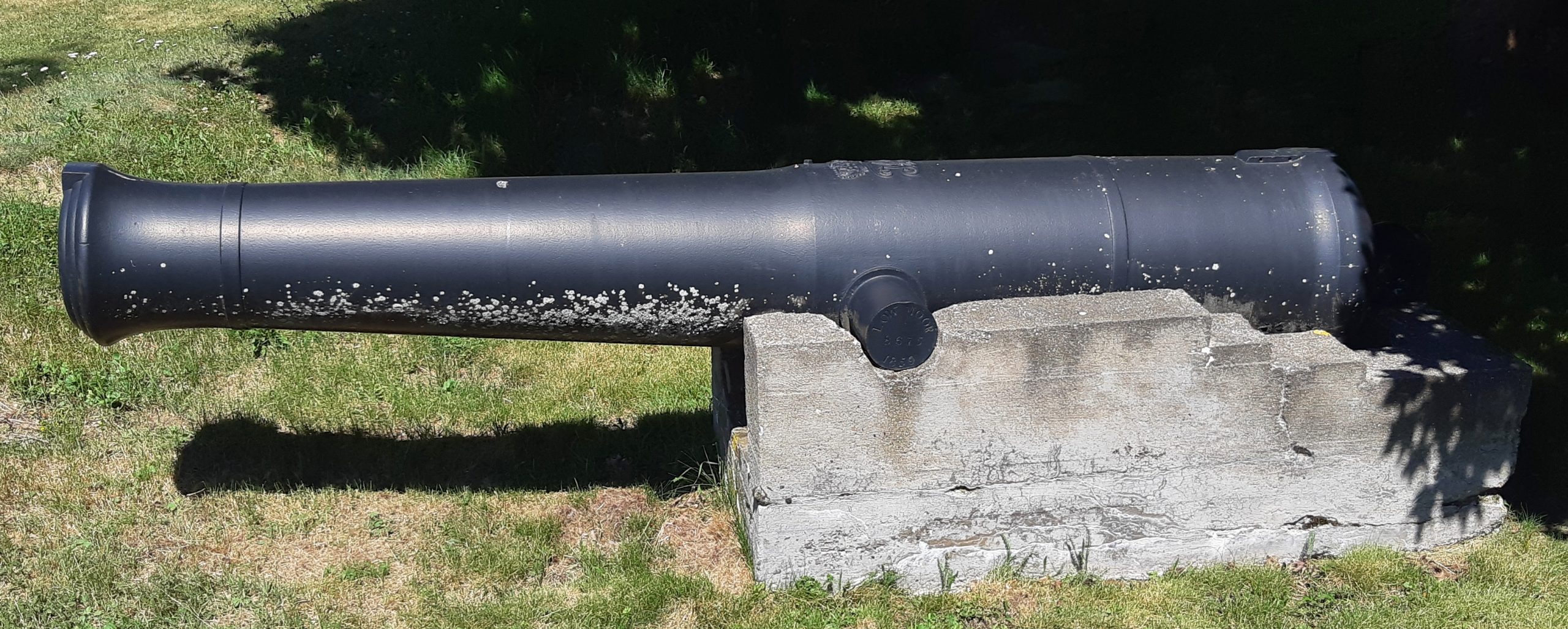
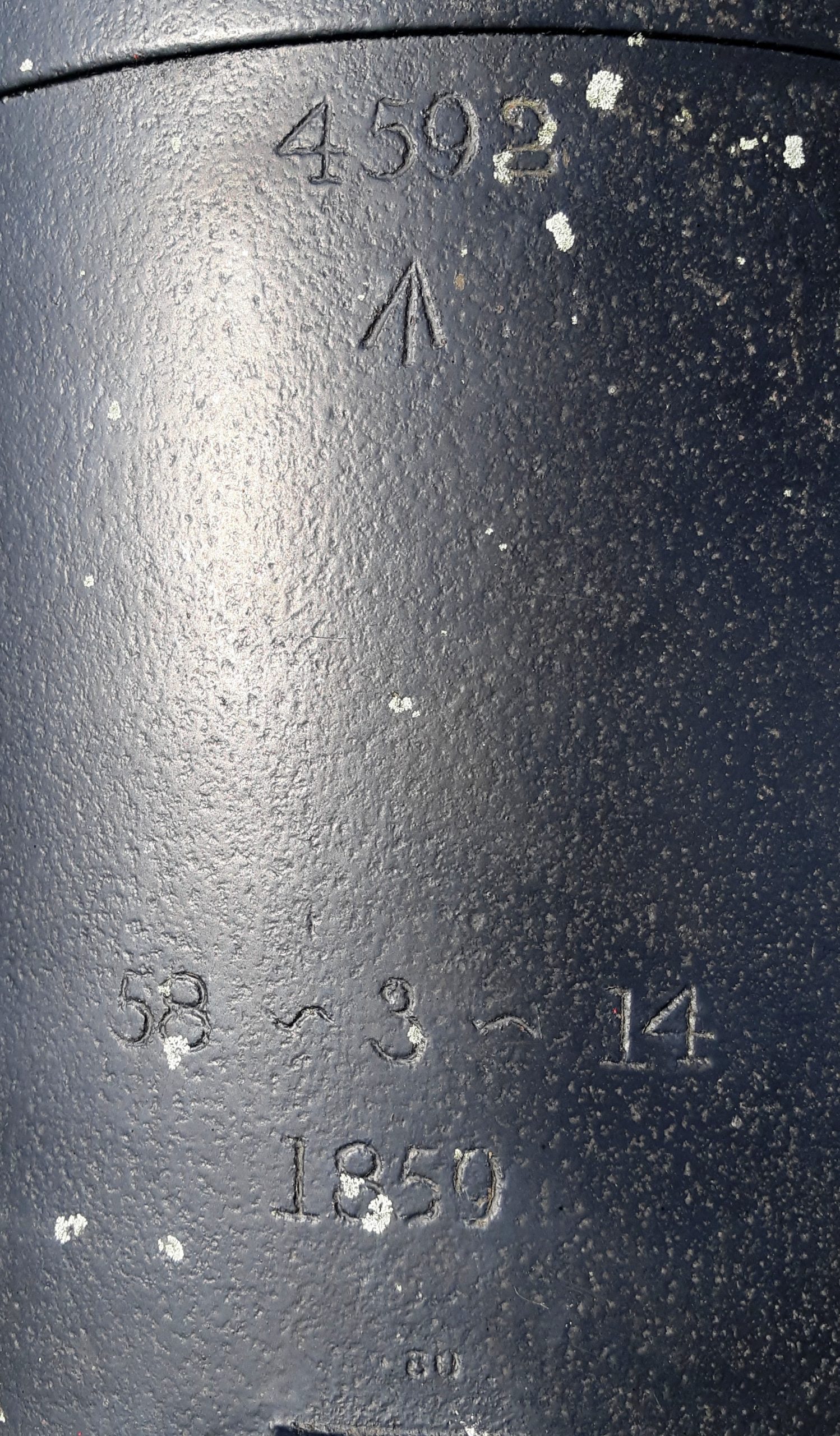
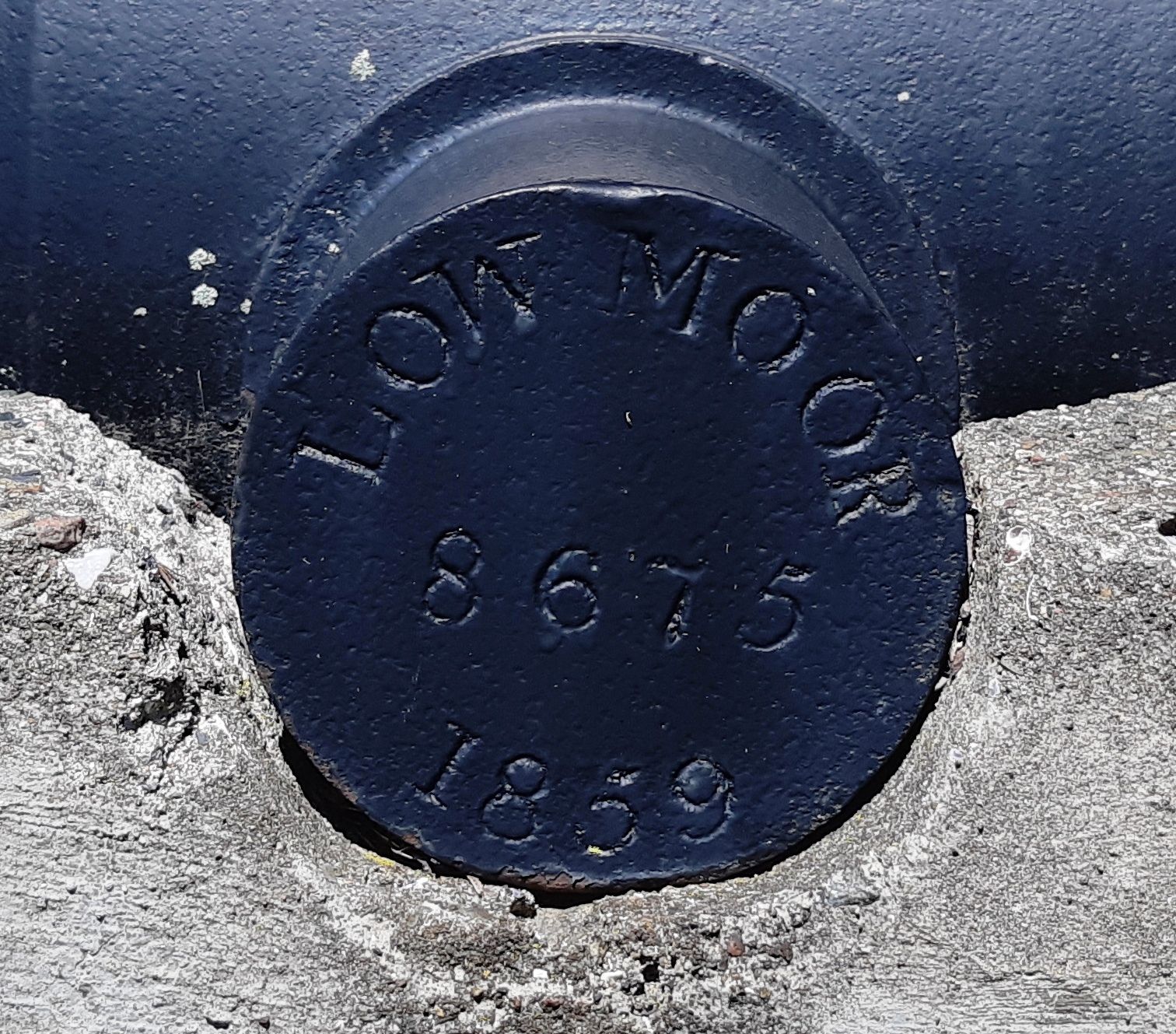
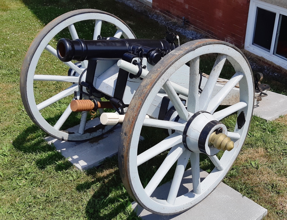
Cast Iron 32-pounder 58-cwt Smoothbore Muzzleloading Gun with Millar pattern breeching ring, weight 58-3-14 (6,588 lbs), 1859, Low Moor Ironworks of Bradford, England (LOW MOOR, 8675, 1859) on the left trunnion, (+) on the right trunnion, Queen Victoria cypher, broad arrow mark, 4593 on the barrel, mounted on a concrete stand. This is gun No. 1 of 2, facing west, behind part of the original Fort Tipperary berm near the Algonquin Hotel.
(Author Photos, 21 July 2020)
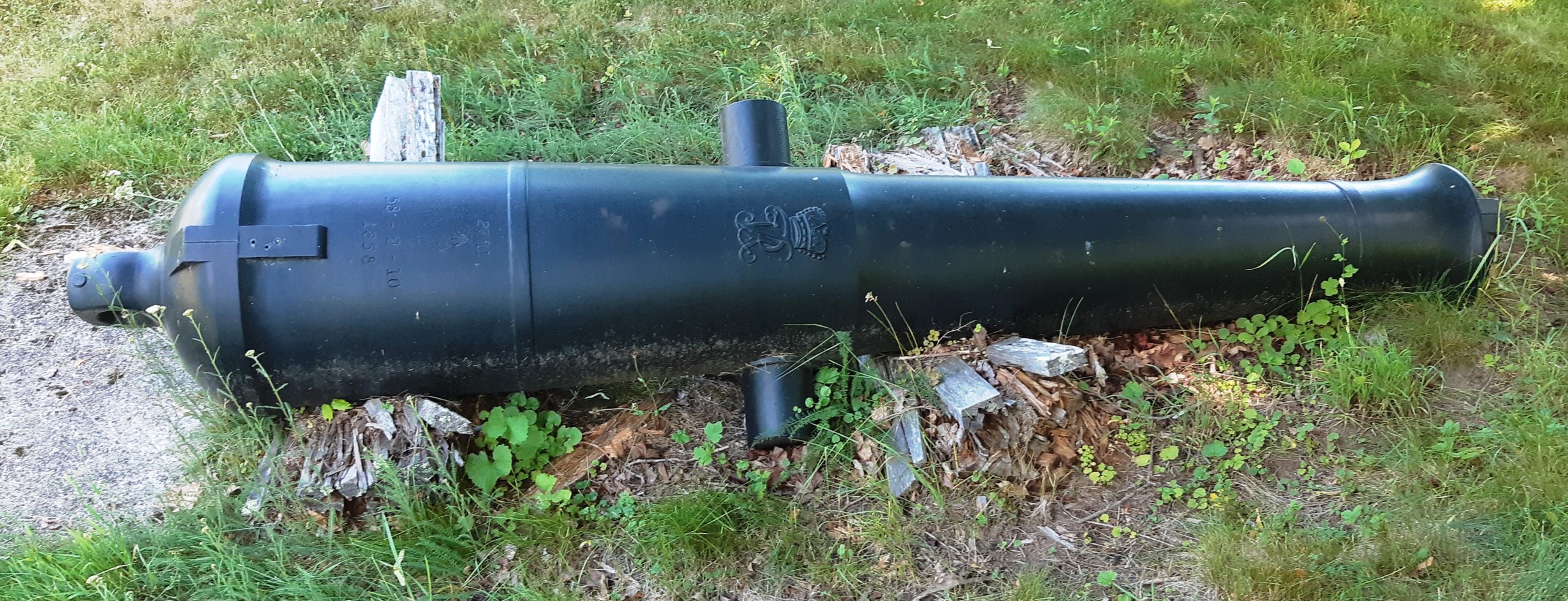
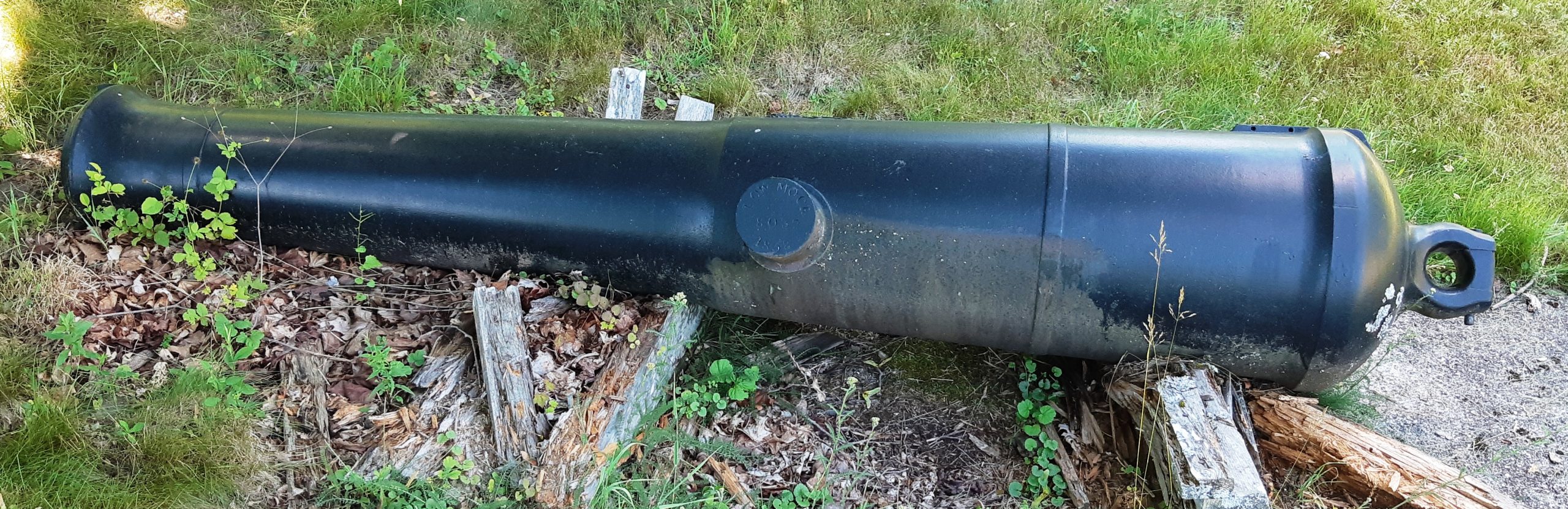
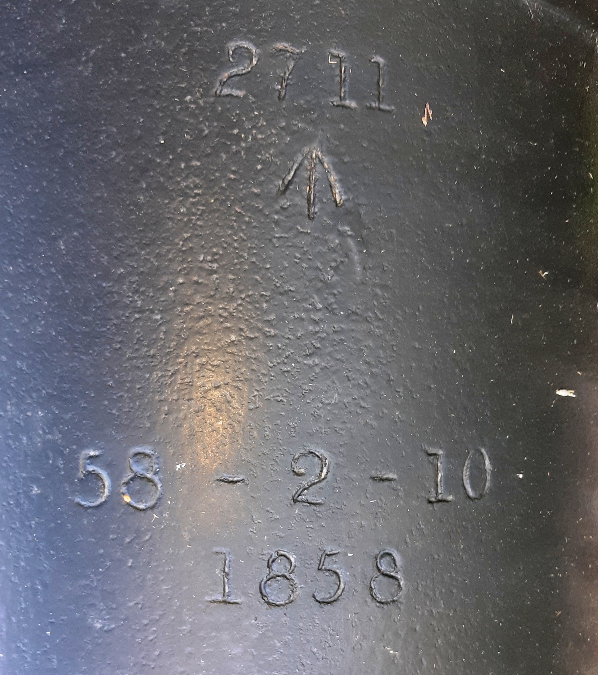
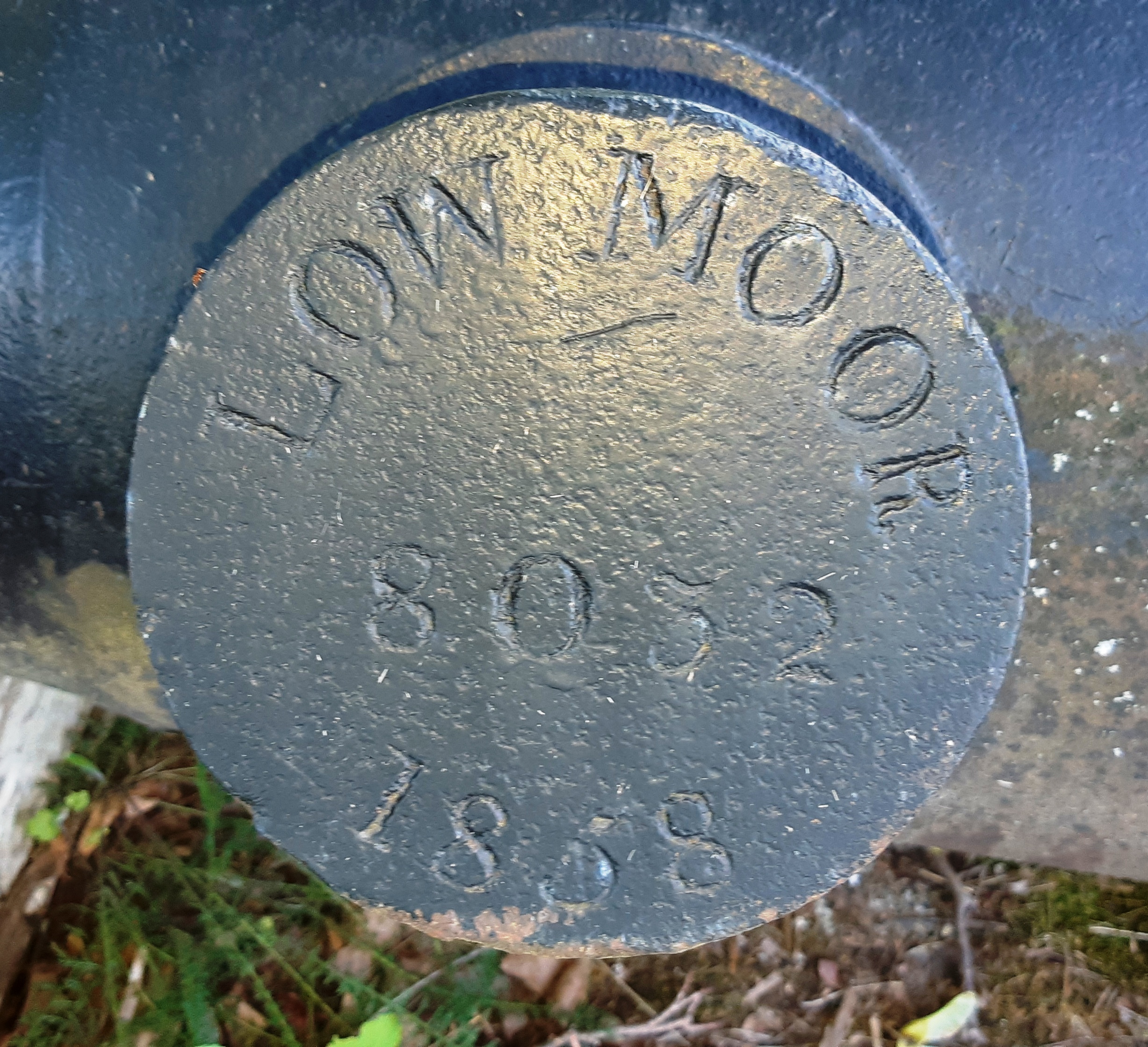
Cast Iron 32-pounder 58-cwt Smoothbore Muzzleloading Gun with Millar pattern breeching ring, weight 58-2-10 (6,558 lbs), 1858, Low Moor Ironworks of Bradford, England (LOW MOOR, 8052, 1858) on the left trunnion, (+) on the right trunnion, Queen Victoria cypher, broad arrow mark, 2711 on the barrel, unmounted. This is gun No. 2 of 2, facing south, near the Algonquin Hotel.
(Author Photos, 21 July 2020)
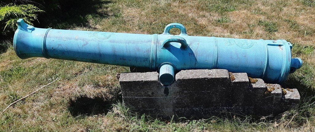
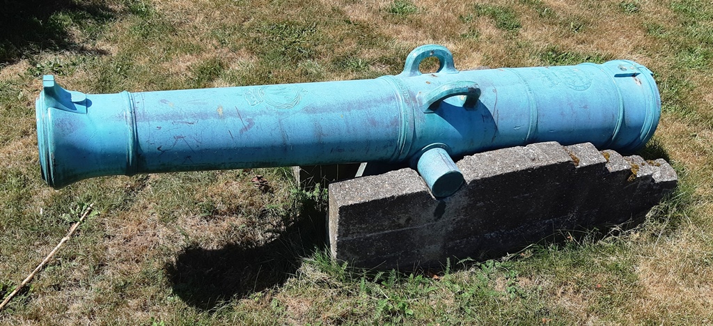
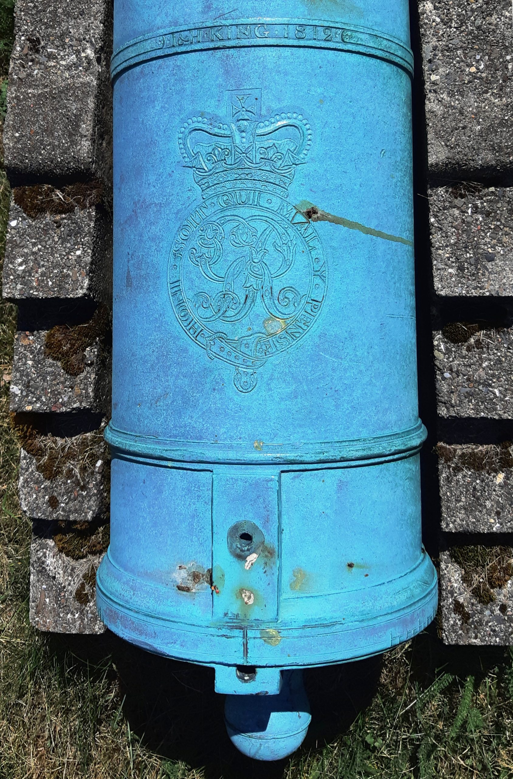
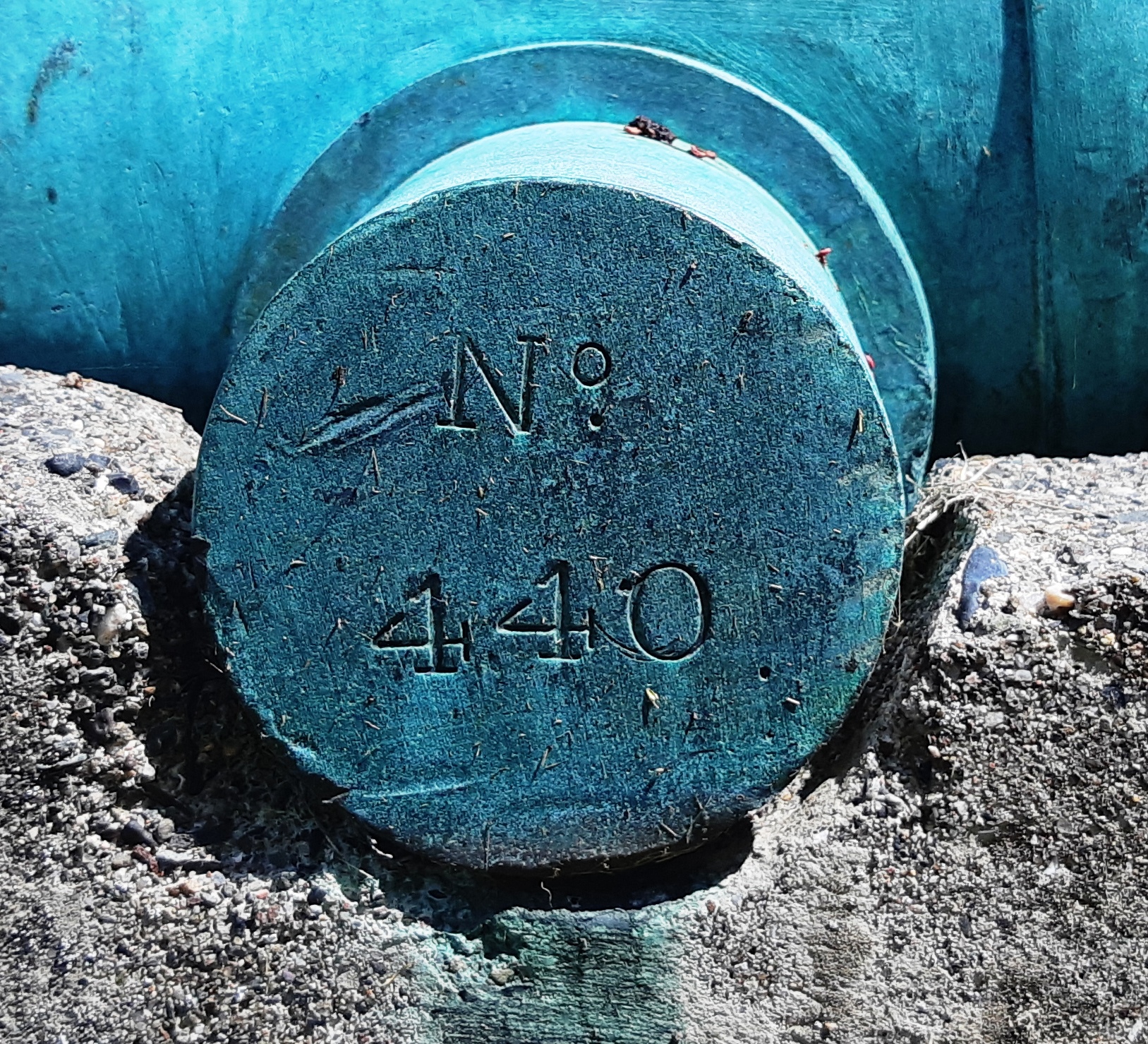
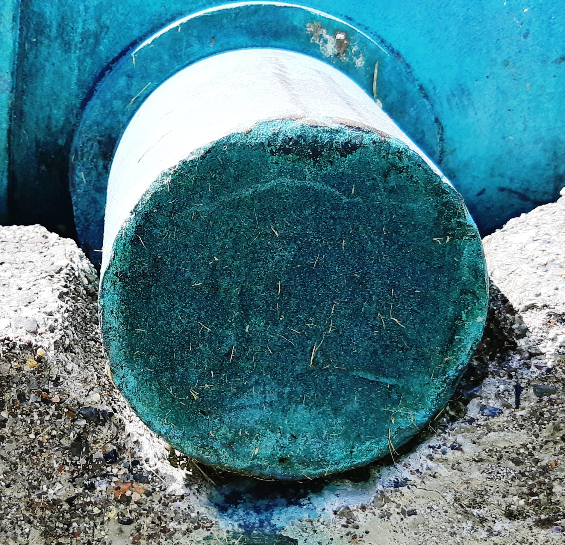
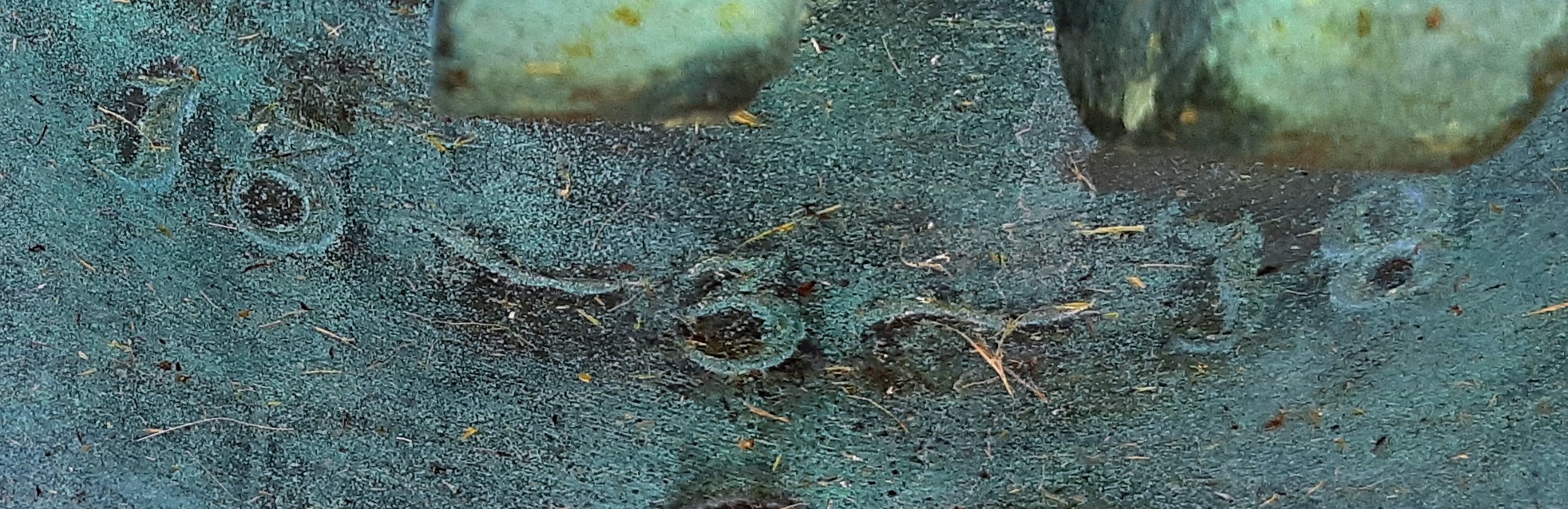
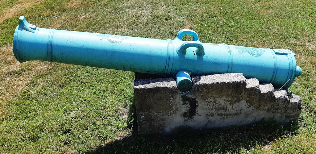
Bronze 9-pounder 13-1/2-cwt Smoothbore Muzzleloading Gun, weight 13-3-18 (1,552 lbs), J & H (John and Henry) King 1812 on the chase, dolphin carrying handles, King George III cypher, M (General Henry Phipps, 1st Earl of Mulgrave, Master General of the Ordnance 1810–1819) cypher, (No. 440) on the left trunnion, blank on the right trunnion, blank on the right trunnion, unmounted. This is gun No. 1 of 2, facing south, near the Algonquin Hotel.

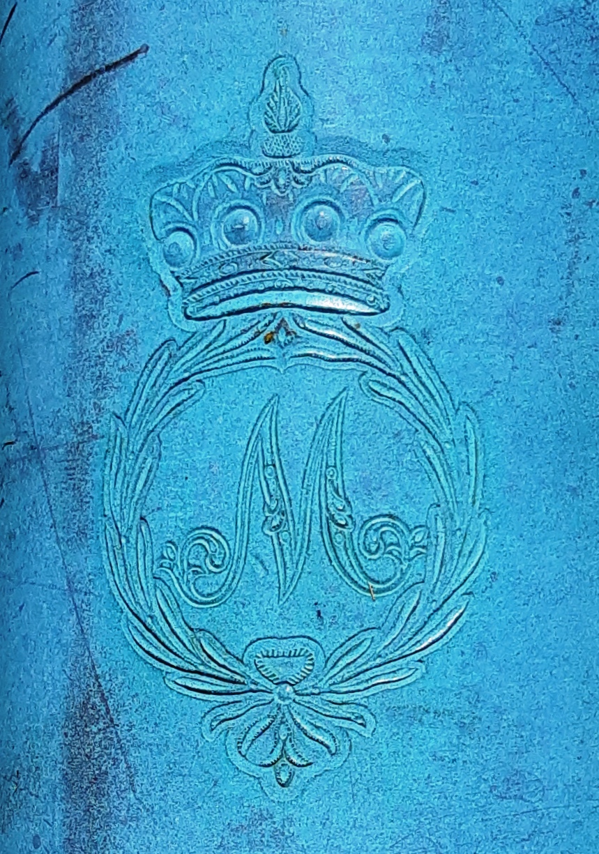
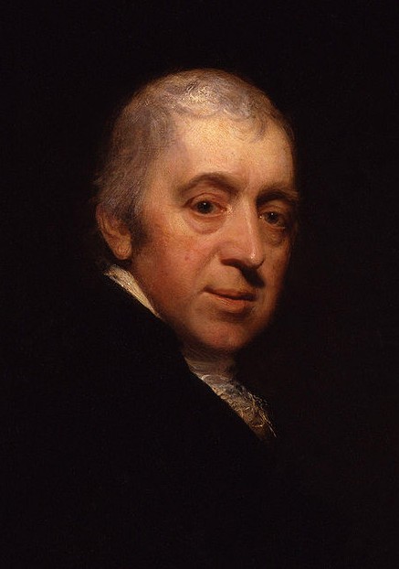
General Henry Phipps, 1st Earl of Mulgrave, Master General of the Ordnance 1810–1819, by Sir William Beechey (Wikipedia), left, and his cypher, right.
(Author Photos, 21 July 2020)
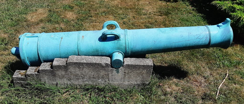
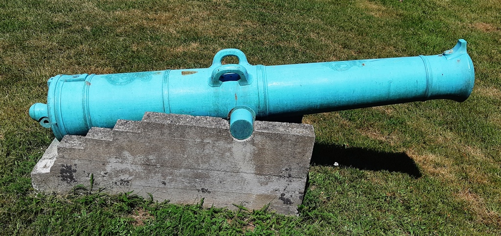
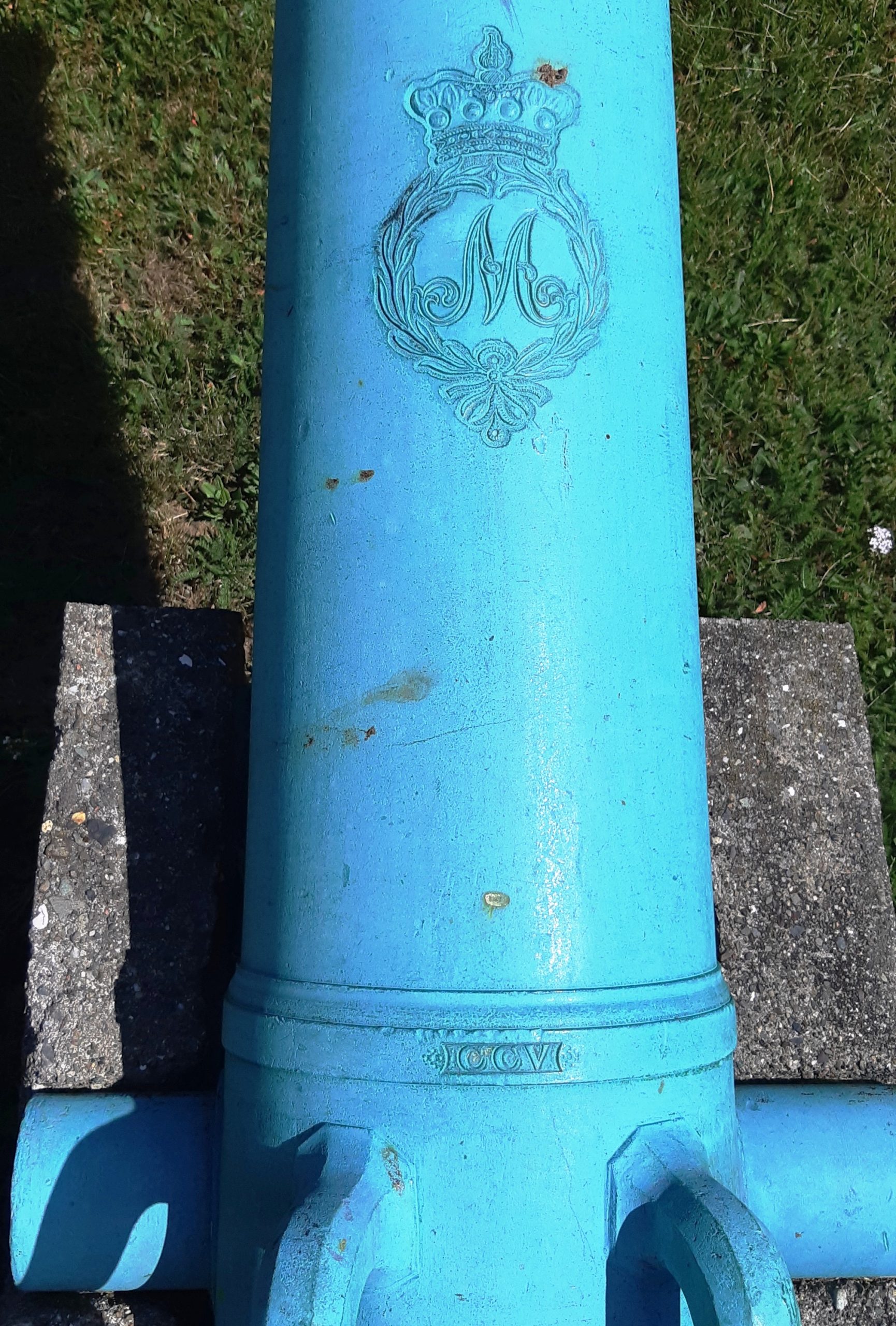
Bronze 9-pounder 13-1/2-cwt Smoothbore Muzzleloading Gun, weight TBC (ca 1,550 lbs), J & H (John and Henry) King 1810 and CCV (205) on the chase, dolphin carrying handles, King George III cypher, M (General Henry Phipps, 1st Earl of Mulgrave, Master General of the Ordnance 1810–1819) cypher, (No. 225) on the left trunnion, blank on the right trunnion, mounted on a concrete stand. This is gun No. 2 of 2, facing East, near the Algonquin Hotel.
(Author Photos, 21 July 2020)
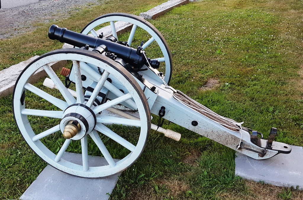
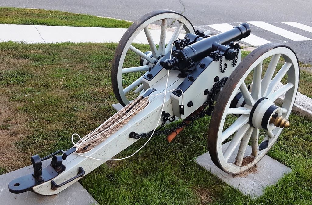
1-pounder (?) SBML percussion fired gun mounted on a wheeled gun carriage near near City Hall.
L’Etang 19th Century British Artillery Battery
A British artillery battery was established near L’Etang in Charlotte County, to control the passage into the harbour late in the eighteenth century.
Dipper Harbour Outpost of the War of 1812
In 1813, Colonel George Anderson established a British Garrison at Dipper Harbour. He built a large two-story house with a lookout tower on the roof. It was 30 feet by 40 feet, built of hewn timbers, with four rooms on each floor and each room with a fireplace. In the basement was the kitchen, a large bake oven and the dinning room. The last visual trace of this building disappeared in 1975 with the construction of a modern restaurant.
Wreck of HMS Plumper
Latitude: 45.0944496, Longitude: -66.4135905
In 1812, HMS Plumper, a gun brig, under command of Lieutenant Josias Bray had successfully captured three small American privateers in the Bay of Fundy. Unfortunately, the brig was caught up in a raging snowstorm at 0400 hours on the morning of 5 December 1812. En route to Saint John from Halifax, with about 75 crew and passengers aboard, HMS Plumper hit a ledge of rock off Dipper Harbour, since named Plumper Head, and sank. Although Bray was among the survivors, forty-two others perished. HMS Plumper carried at least 36,000 pounds sterling in gold and silver specie to pay the British garrison. There have been numerous and varied local accounts concerning the recovery of the gold. Records do show that the British authorities recovered about half the money immediately after the sinking. The wreck is a protected provincial historic site.
All comments are subject to our Comment Policy. You must be at least 18 years old to comment.
See a comment that violates our guidelines? Report it here.